Getting Started with ArcGIS: A Beginner’s Guide to Mastering Geospatial Analysis
Geospatial analysis is a powerful tool that allows us to understand …
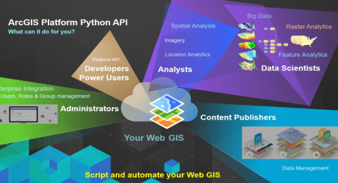
ArcGIS Python Automation: Streamlining Workflows for GIS Professionals
With ArcGIS Python automation, the focus can shift from mundane administrative …
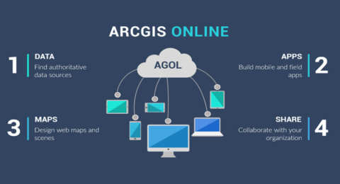
ArcGIS Online: Collaborative Mapping and Storytelling for GIS Professionals
In today's interconnected world, collaboration and effective communication are key to …
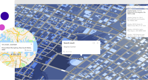
Geocoding and Geoprocessing: Enhancing GIS Analysis with ArcGIS Tools and APIs
Geocoding and geoprocessing are two fundamental techniques that enhance GIS analysis, …

Harnessing the Power of Remote Sensing with ArcGIS
Remote sensing, the science of acquiring information about the Earth's surface …

Advanced Techniques Every GIS Professional Should Know
Geographic Information System (GIS) technology has transformed the way we analyze …
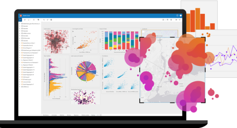
ArcGIS Insights: A Comprehensive Data Analysis Tool for GIS Professionals
In the realm of Geographic Information Systems (GIS), the ability to …
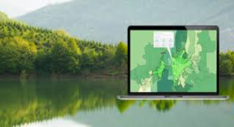
ArcGIS for Forest Monitoring: An Essential Tool for Environmental Conservation
Forests are vital ecosystems that provide numerous benefits, including carbon sequestration, …
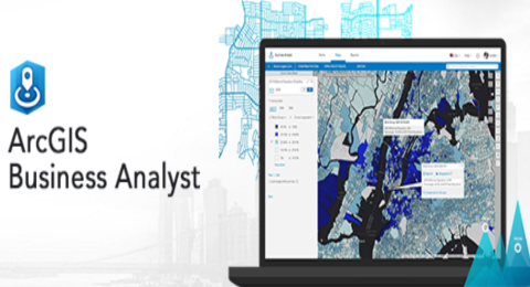
ArcGIS Business Analyst: A Powerful Tool for Market Analysis and Planning
In today's competitive business landscape, making informed decisions is crucial for …
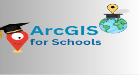
ArcGIS for Schools: Empowering the Next Generation of GIS Professionals
Geographic Information System (GIS) technology has become an essential tool in …

Announcement of an Acting CEO at Esri Eastern Africa
We request that you all join us in welcoming Mr. Samuel …
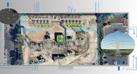
ArcGIS for Electric Utilities; optimizing grid performance & maintenance
The electricity grid is the backbone of modern society, powering homes, …
- 1
- 2