ArcGIS Online: Collaborative Mapping and Storytelling for GIS Professionals
June 12, 2023 2023-06-13 8:09ArcGIS Online: Collaborative Mapping and Storytelling for GIS Professionals
ArcGIS Online: Collaborative Mapping and Storytelling for GIS Professionals
In today’s interconnected world, collaboration and effective communication are key to successfully leveraging geographic information. Therefore, GIS professionals need tools that not only allow them to analyze and visualize spatial data but also enable them to share their insights and tell compelling stories. ArcGIS Online, a web-based mapping platform developed by Esri, provides a powerful solution for collaborative mapping and storytelling. In this article, we will explore how ArcGIS Online empowers GIS professionals to collaborate, create interactive maps, and communicate their findings effectively.
Related: ArcGIS Navigator: The Ultimate GPS Navigation Solution
How ArcGIS Online empowers GIS professionals to collaborate and create maps
Here is how ArcGIS Online (AGOL) empowers GIS professionals to collaborate, create interactive maps, and communicate their findings effectively:
Collaborative mapping
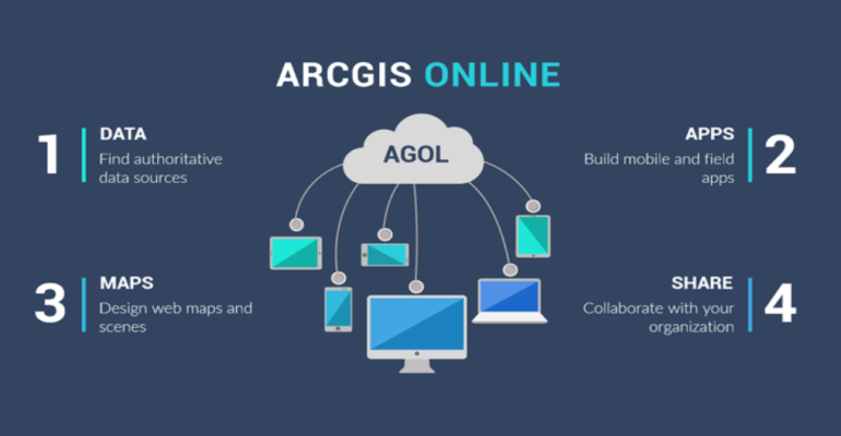
AGOL serves as a centralized hub where GIS professionals can access, share, and collaborate on spatial data and maps. With its intuitive interface and cloud-based infrastructure, it enables teams to work together seamlessly, regardless of their physical location. Multiple users can contribute to a map simultaneously, making it easier to gather and incorporate diverse perspectives. Through shared data, web layers, and hosted feature services, GIS professionals can collaborate on projects, update information in real-time, and ensure that everyone is working with the most up-to-date data.

Web map creation
ArcGIS Online provides a user-friendly environment for creating interactive web maps without the need for advanced programming skills. GIS professionals can bring their data to life by adding layers, symbology, and pop-ups to the map. They can also incorporate basemaps, such as imagery, topographic maps, or street maps, to provide context and enhance visualizations. It offers a wide range of tools to customize maps, including measurement tools, drawing tools, and filtering options, enabling GIS professionals to tailor their maps to specific needs and create informative and engaging visualizations.
Storytelling with maps
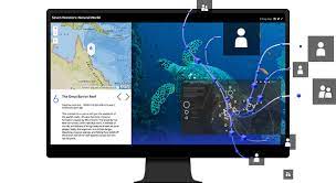
One of the standout features of ArcGIS Online is the ability to create story maps, which combine maps, multimedia content, and narrative text to tell a compelling story. GIS professionals can use story maps to communicate their findings, present data-driven narratives, and engage a wider audience. With a variety of story map templates available, including Cascade, Journal, and Swipe, GIS professionals can choose the format that best suits their storytelling needs. They can incorporate images, videos, charts, and text to provide context, present analysis, and guide viewers through the map-based narrative.
Related: Simplified Learning with ArcGIS Story Maps
Data sharing and publishing
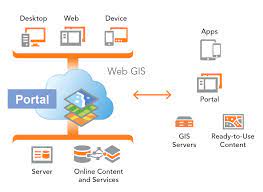
ArcGIS Online facilitates easy data sharing and publishing, allowing GIS professionals to disseminate their work to a broader audience. With just a few clicks, users can share maps, apps, and data with colleagues, stakeholders, and the public. This software provides options to control access and permissions, ensuring that sensitive data remains secure. GIS professionals can also publish their maps as web services, making them accessible to other GIS applications and enabling integration with other platforms. This seamless data sharing and publishing process foster collaboration and promote the use of spatial information across different domains.
Related: ArcGIS Business Analyst: A Powerful Toll for Market Analysis and Planning
Integration with other Esri tools
AGOL seamlessly integrates with other Esri tools, expanding its capabilities and providing a comprehensive GIS ecosystem. Users can leverage ArcGIS Online’s web maps and data in applications like ArcGIS Pro, ArcGIS Collector, and ArcGIS Explorer, enabling smooth data transfer and synchronization. This integration allows GIS professionals to work seamlessly across different platforms, leverage the strengths of each tool, and enhance their analysis and data management workflows.
In conclusion, AGOLserves as a powerful platform for GIS professionals to collaborate, create interactive maps, and communicate their findings effectively. Its collaborative mapping features, web map creation capabilities, storytelling tools, data sharing options, and integration with other Esri tools make it a versatile and essential tool for GIS professionals. By harnessing the power of ArcGIS Online, GIS professionals can foster collaboration, engage stakeholders, and unlock the true potential of spatial information in their organizations.
If you’re looking to purchase AGOL, click here!

