Seven Ways to Integrate Data with ArcGIS Online
January 10, 2025 2025-01-10 8:02Seven Ways to Integrate Data with ArcGIS Online
Seven Ways to Integrate Data with ArcGIS Online
ArcGIS Online enables users to store, manage, and share spatial data in various formats, including files, web layers, and connections to other data sources. This data serves as the backbone for visualization, analysis, and editing workflows.
To fully unlock the potential of your data in ArcGIS Online, integrating it effectively and keeping it up to date is crucial. Here are seven methods to incorporate data into ArcGIS Online.
1. Directly from the Source
For static data that does not change frequently, you can easily upload it to ArcGIS Online directly from its source. Data stored on local drives, networks, or cloud platforms like Microsoft OneDrive, Google Drive, and Dropbox can be added to the platform.
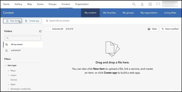
ArcGIS Online supports various formats, including zipped shapefiles, zipped file geodatabases, and CSV files with location data. Users can upload these through the My Content tab by selecting New Item or by simply dragging the files into the interface. From there, users can transform these files into web layers for use in web maps, applications, or analysis tools.
For data that updates regularly, maintaining accuracy can be a challenge. Automating updates through Python scripting or manually overwriting the data are viable solutions.
2. ArcGIS Data Pipelines
When data requires cleaning, formatting, or transformation before use, ArcGIS Data Pipelines is an ideal solution. This built-in tool in ArcGIS Online provides a low-code, drag-and-drop interface to design workflows that prepare data for analysis and mapping.
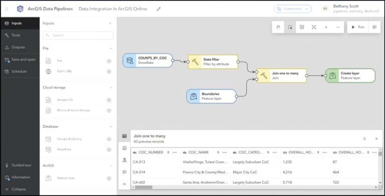
Data Pipelines securely connects to cloud-based storage such as Snowflake, Google BigQuery, Amazon S3, and Azure Blob Storage. It also supports public URLs and existing feature layers. With scheduling functionality, users can automate pipelines to keep data synchronized and up to date as changes occur.
3. ArcGIS Velocity
For integrating real-time data such as IoT feeds or data from APIs, ArcGIS Velocity is a powerful option. This extension supports real-time situational awareness by ingesting data on live assets like vehicles or environmental sensors.
ArcGIS Velocity also provides advanced analytics tools like dynamic geofencing and alerts to deliver actionable insights. It is an excellent choice for projects requiring constant data updates and real-time decision-making.
4. Sharing from ArcGIS Pro
ArcGIS Pro seamlessly integrates with ArcGIS Online, enabling users to share curated datasets as web layers, maps, or scenes. ArcGIS Pro supports a wide variety of data sources, including enterprise geodatabases and cloud data warehouses.
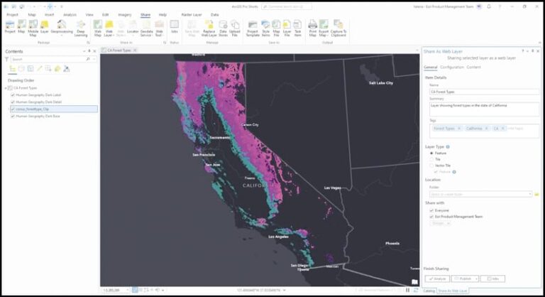
Once data is processed in ArcGIS Pro, it can be published to ArcGIS Online, allowing collaboration and accessibility from anywhere. Updates to shared data can be automated using Python scripting or manually overwritten as needed.
5. The ArcGIS Data Interoperability Extension
For complex data transformations, the ArcGIS Data Interoperability extension provides advanced extract, transform, and load (ETL) capabilities. This no-code tool connects to a wide range of inputs and file types, enabling robust data engineering.
Users can schedule recurring updates through ArcGIS Server to ensure data remains synchronized. This extension is a strong choice for handling intricate workflows that require repeated transformations and integrations.
6. ArcGIS Python Libraries
When custom or automated solutions are necessary, the ArcGIS Python libraries, including the ArcGIS API for Python and ArcPy, offer powerful scripting capabilities. These libraries enable users to connect to diverse data sources, perform advanced manipulations, and publish results to ArcGIS Online.
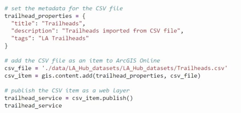
Python scripts can be authored and executed directly within ArcGIS Notebooks or externally, offering flexibility for automation and integration tasks.
7. Distributed Collaboration
For organizations using both ArcGIS Online and ArcGIS Enterprise, distributed collaboration facilitates seamless sharing between the two systems. This approach eliminates the need for scripting and allows synchronized updates to content such as maps, apps, and feature layers.
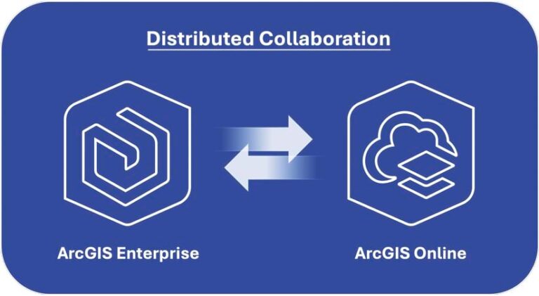
Feature layers can even be edited in one system and synced with the other, ensuring that data remains consistent across platforms.
Unlock the Full Potential of Your Data
Effective data integration in ArcGIS Online empowers organizations to perform spatial analyses, create impactful maps, and address complex challenges. Choosing the right integration method depends on project requirements and organizational goals.
To explore additional resources, visit the Esri Community blog post, “Seven Ways to Integrate Data with ArcGIS Online: Additional Resources.” For questions or suggestions, join the conversation on Esri Community.
Disclaimer: This article was originally published in ArcNews by Esri.


