Streamlining Field Operations with ArcGIS
March 13, 2025 2025-03-13 10:24Streamlining Field Operations with ArcGIS

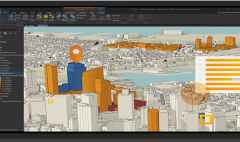
Efficient field operations are critical for organizations managing assets, infrastructure, or remote projects. However, traditional methods of navigation, data collection, and task coordination often lead to inefficiencies. ArcGIS provides a comprehensive suite of tools that streamline workflows, improve data accuracy, and enhance real-time collaboration between field teams and office staff. This article explores key areas where ArcGIS enhances field operations: workflows, challenges, and solutions.
https://www.youtube.com/watch?v=Gpfxqo6uGgc
Related: How ArcGIS Field Maps can Revolutionize Field Data Collection
Optimizing Field Operation Workflows
Field crews play a crucial role in asset management, environmental monitoring, and infrastructure maintenance. Their ability to navigate efficiently, collect accurate data, and coordinate tasks directly impacts project success. ArcGIS facilitates:
- Navigation Assistance: Mobile teams can use interactive maps to find the fastest route to their destination, reducing time spent searching for assets or project sites.
- Spatial Awareness: Field workers can access maps that highlight surrounding features such as lakes, forests, or restricted zones, helping them avoid hazards.
- Data Collection: Using apps like Survey123, QuickCapture and Field Maps, teams can collect real-time data, update records, and share findings instantly.
- Task Management: With tools like ArcGIS Workforce, managers can assign tasks, track progress, and optimize workforce deployment.
These capabilities ensure field teams operate with efficiency, accuracy, and safety, leading to better decision-making and faster project completion.
Related: Tips and Tricks: Field Data Collection Best Practices
Challenges in Field Operations & How to Overcome Them
Despite technological advancements, field operations still face several challenges:
1. Lack of Real-Time Data Access
Traditional workflows often rely on paper-based data collection, leading to delays in data processing. Field teams may lack access to maps, asset details, or work orders. Solution: ArcGIS enables seamless data synchronization between field and office staff, ensuring real-time access to critical information.
2. Heavy Reliance on Paper-Based Workflows
Paper records are prone to errors, loss, and inefficiency. Solution: Digitizing data collection with ArcGIS applications enhances accuracy, speeds up reporting, and reduces environmental impact.
3. Security & Data Integrity Issues
Without proper security measures, sensitive field data may be exposed. Solution: Role-based access control within ArcGIS ensures only authorized personnel can access and edit data.
4. Disconnected Field & Office Teams
Delays in communication between field teams and office staff often result in inefficiencies. Solution: ArcGIS Dashboards provide real-time visibility into field operations, allowing office teams to monitor progress, assign resources, and make informed decisions.
5. Poor Coordination & Task Assignment
Assigning tasks manually can lead to duplication or inefficiencies. Solution: ArcGIS Workforce enables managers to assign tasks efficiently, track progress, and ensure proper workload distribution among field staff.
Who is Involved in Field Operations?
Effective field operations require collaboration between multiple roles, including:
- Mobile Workers & Field Crews: Responsible for data collection, inspections, and maintenance.
- GIS Analysts & Dispatchers: Manage data integration, map updates, and task assignments.
- Supervisors & Decision-Makers: Oversee operations, track progress, and make data-driven decisions.
By leveraging ArcGIS technology, organizations can streamline workflows, overcome challenges, and improve overall efficiency in field operations. Whether working in connected or disconnected environments, ArcGIS ensures that teams have the tools they need to work smarter and faster.
Ready to optimize your field operations? Explore the power of ArcGIS today.