A Deep Dive into Africa GeoPortal: Essential Tools for GIS Professionals
October 14, 2024 2024-10-16 7:51A Deep Dive into Africa GeoPortal: Essential Tools for GIS Professionals
A Deep Dive into Africa GeoPortal: Essential Tools for GIS Professionals
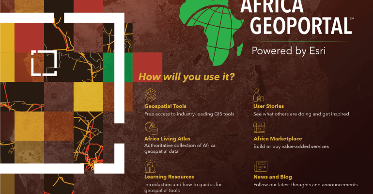
Geographic Information Systems (GIS) have become critical for addressing the complex challenges faced by governments, businesses, and organizations across Africa. From managing natural resources to urban planning and disaster response, the need for reliable, accessible, and authoritative geospatial data is greater than ever. The Africa GeoPortal, powered by Esri, provides a robust platform for GIS professionals, offering a wealth of geospatial data, mapping tools, and resources tailored specifically to the African context.
In this article, we will take a deep dive into the Africa GeoPortal and explore the essential tools it offers to GIS professionals, making it an indispensable resource for solving the continent’s most pressing issues.

Introduction to Africa GeoPortal
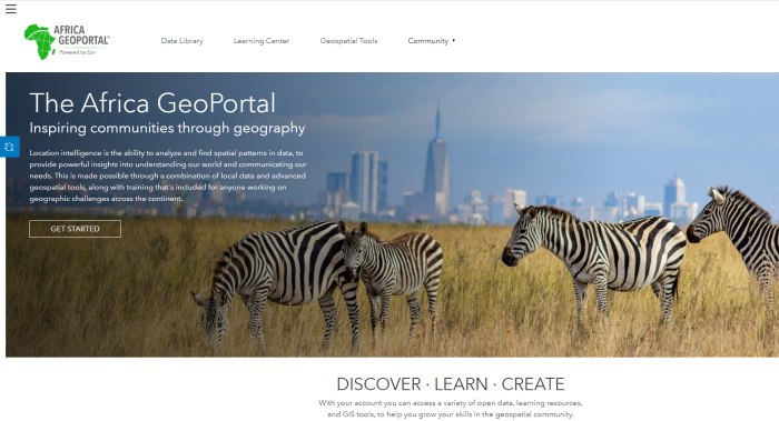
The Africa GeoPortal is a cloud-based platform designed to give GIS professionals, governments, NGOs, and researchers access to high-quality geospatial data and tools tailored for the unique needs of Africa. Built on Esri’s ArcGIS technology, it brings together a variety of datasets, analytical tools, and mapping resources, all in one easily accessible portal.
The Africa GeoPortal was developed with the vision of enhancing the ability of decision-makers to address critical development issues such as climate change, food security, urbanization, and disaster management. By offering free access to tools like ArcGIS Online, ArcGIS Living Atlas, and a wealth of authoritative data, the platform empowers users to make data-driven decisions, improving the efficiency and effectiveness of their projects.
1. Access to Authoritative Geospatial Data
One of the standout features of the Africa GeoPortal is its vast repository of high-quality geospatial data, sourced from reliable organizations such as government agencies, research institutions, and global initiatives. This data is curated to provide African users with the most relevant and up-to-date information for their projects.
Key Datasets Available on the Africa GeoPortal:
- Demographic Data: Detailed datasets covering population density, age distribution, income levels, and migration patterns. These are crucial for urban planning, infrastructure development, and policy-making.
- Environmental and Land Use Data: Data on land cover, vegetation, deforestation, and protected areas, which support conservation efforts, environmental monitoring, and sustainable land management.
- Infrastructure Data: Maps of transportation networks, utility infrastructure, and public services that help urban planners and government agencies design resilient cities and manage public resources effectively.
- Climate and Weather Data: Real-time and historical data on temperature, precipitation, and extreme weather events, enabling organizations to plan for climate resilience and disaster preparedness.
- Agricultural Data: Detailed information on soil types, crop yields, and agricultural zones, helping farmers and agricultural planners optimize land use and improve food security.
2. Essential GIS Tools for Analysis and Mapping
The Africa GeoPortal provides free access to some of the most powerful GIS tools available, allowing users to perform complex spatial analysis and create interactive maps that bring data to life. These tools are vital for professionals who need to visualize, analyze, and interpret geographic data to make informed decisions.
Key Tools Available on the Africa GeoPortal:
- ArcGIS Online ArcGIS Online is the core mapping and spatial analysis tool available through the Africa GeoPortal. It allows users to create interactive maps, visualize data layers, and perform spatial analysis. Whether you’re mapping urban expansion, monitoring deforestation, or analyzing population trends, ArcGIS Online provides the tools needed to visualize and interpret spatial data effectively.
- ArcGIS Living Atlas The ArcGIS Living Atlas of the World is integrated into the Africa GeoPortal, giving users access to a rich repository of ready-to-use maps, datasets, and analytical layers. The Living Atlas provides data on topics such as land use, climate change, biodiversity, and real-time weather. This resource is invaluable for professionals working on projects that require access to global datasets with a local focus.

- StoryMaps StoryMaps are an innovative tool that allows users to combine maps with narrative text, images, and multimedia content to create compelling visual stories. For GIS professionals in Africa, StoryMaps offer a unique way to present data and insights in a format that is engaging and accessible to a wider audience. This tool is particularly useful for NGOs, government agencies, and research institutions that need to communicate complex data-driven findings to stakeholders, policymakers, or the public.
- ArcGIS Dashboards Dashboards provide an interactive way to visualize key metrics and datasets in real time. Using ArcGIS Dashboards, professionals can create dynamic interfaces that display live data feeds, helping organizations monitor key indicators such as public health data, traffic congestion, and environmental conditions. This tool is crucial for decision-making in disaster response, public health management, and urban planning, where real-time data is essential.
Related: Top Datasets from ArcGIS Living Atlas for Urban Planning and Development
3. Applications in Key Sectors
The Africa GeoPortal is designed to address the unique challenges faced by the African continent. GIS professionals across various sectors are using the platform to make informed decisions, enhance operational efficiency, and promote sustainable development.
a. Urban Planning and Infrastructure Development
With rapid urbanization in many African cities, urban planners are using the Africa GeoPortal to access demographic data, transportation networks, and land use patterns to design more efficient, resilient cities. By overlaying multiple datasets, planners can identify areas for infrastructure development, predict future growth patterns, and ensure that new developments are well-connected to essential services like water, electricity, and public transportation.
b. Agriculture and Food Security
Agricultural planners and farmers are leveraging the Africa GeoPortal’s rich datasets on soil quality, climate conditions, and crop distribution to optimize land use and increase agricultural productivity. The platform provides tools for precision farming, enabling users to assess soil health, monitor crop conditions, and manage water resources more effectively. By using these tools, agricultural professionals can make data-driven decisions to improve yields, reduce waste, and enhance food security across the continent.
c. Environmental Conservation and Natural Resource Management
Africa is home to some of the world’s most biodiverse ecosystems, but these environments are increasingly under threat from deforestation, mining, and climate change. Conservationists and environmental agencies are using the Africa GeoPortal to monitor protected areas, track biodiversity, and map deforestation rates. The platform’s powerful analytical tools enable users to assess the health of ecosystems, plan conservation efforts, and manage natural resources in a sustainable way.
d. Disaster Management and Climate Resilience
The Africa GeoPortal provides critical tools for disaster management and climate resilience. Governments and humanitarian organizations use real-time data and weather monitoring tools to respond to natural disasters such as floods, droughts, and wildfires. The platform allows for the integration of real-time satellite imagery, enabling rapid assessment of affected areas and improving coordination in disaster response efforts. Additionally, long-term climate data helps decision-makers plan for climate resilience, ensuring that infrastructure and communities are better equipped to handle extreme weather events.
4. Collaborative Data Sharing and Analysis
One of the major advantages of the Africa GeoPortal is its collaborative nature. Users can share datasets, maps, and analytical results with colleagues, partners, and the wider GIS community. This is particularly valuable in Africa, where regional cooperation and data-sharing are essential for addressing transboundary issues like water management, conservation, and disaster response.
Key Features for Collaboration:
- Public Sharing of Maps and Data: Users can make their maps and datasets publicly accessible, allowing other professionals to benefit from their work and contribute their own insights.
- Community Contributions: The platform fosters a sense of collaboration by enabling users to upload their own data, creating a shared resource for the entire African GIS community.
- Interactive Map Layers: Users can create and share map layers that other organizations can build on, improving the overall quality and richness of the data available on the platform.
5. Training and Capacity Building
The Africa GeoPortal also supports the professional development of GIS users across the continent. It offers access to free training resources, webinars, tutorials, and documentation to help users become proficient in GIS tools and techniques. This focus on capacity building ensures that African professionals have the skills needed to leverage GIS technology effectively, fostering innovation and improving decision-making across sectors.
The Africa GeoPortal is a game-changer for GIS professionals across Africa. With its powerful tools, access to high-quality geospatial data, and focus on collaboration and capacity building, the platform is enabling organizations and governments to tackle complex development challenges with data-driven precision. Whether you’re working in urban planning, agriculture, disaster management, or environmental conservation, the Africa GeoPortal offers the tools and resources needed to make informed decisions that can shape a more sustainable and resilient future for the continent.
By harnessing the power of the Africa GeoPortal, GIS professionals can unlock new opportunities for growth, development, and collaboration, helping Africa navigate the challenges and opportunities of the 21st century.
Empower your decision-making with the advanced tools and data from Africa GeoPortal—visit the Esri Eastern Africa Online Store to explore GIS solutions that can drive sustainable development across the continent!

