
Unleashing Data’s Potential in Banking
With the drastic developments in the banking industry, it's only fair …

GIS Career Suggestions to Help you Land Your Dream Job
If you’re having problems getting your foot in the door for …
Managing, Processing and Analysis of Drone Imagery with Site Scan for ArcGIS
Site Scan for ArcGIS is an end-to-end cloud-based drone mapping tool …

Discover the Digital Mapping Industry: GIS
Despite being unknown, GIS technology is frequently used in our everyday …

What Does a GIS Analyst Do?
A GIS analyst is a hybrid career combining data analysis, cartography …

Turning Drone Imagery to Geospatial Intelligence
Drones are changing how we work in practically every aspect, and …

Modern Technology Developing the Ancient World
To build a more sustainable future, we must make the most …
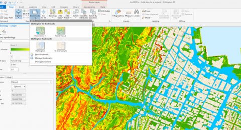
Imagery Analysis in ArcGIS Pro
Imagery analysis is a 3-day course that not only focuses on …

Add GIS Skills to Your Portfolio
A career in which GIS is an integral part of your …

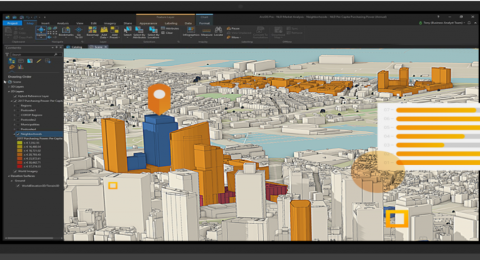
Evaluating Urban Development Plans with ArcGIS GeoPlanner
Due to limited land resources, development demands, and intricate planning procedures, …

Leveraging GIS for Sustainable African Cities
Like the rest of the world, the rapid growth in population …
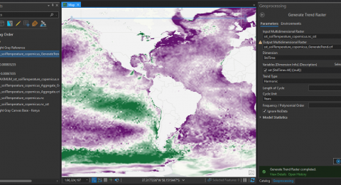
How to Perform Multidimensional raster analysis in ArcGIS Pro
Multidimensional data represents data captured at multiple times or multiple depths …