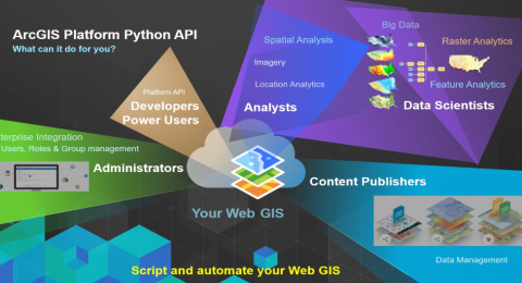
ArcGIS Python Automation: Streamlining Workflows for GIS Professionals
With ArcGIS Python automation, the focus can shift from mundane administrative …
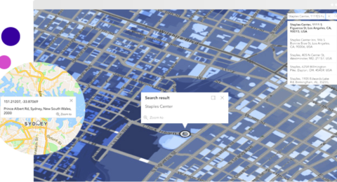
Geocoding and Geoprocessing: Enhancing GIS Analysis with ArcGIS Tools and APIs
Geocoding and geoprocessing are two fundamental techniques that enhance GIS analysis, …
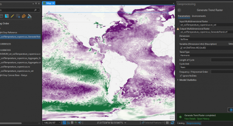
How to Perform Multidimensional raster analysis in ArcGIS Pro
Multidimensional data represents data captured at multiple times or multiple depths …