Discover Data and Maps on ArcGIS Living Atlas
November 5, 2024 2024-11-05 11:33Discover Data and Maps on ArcGIS Living Atlas
Discover Data and Maps on ArcGIS Living Atlas
The ArcGIS Living Atlas of the World is a dynamic and comprehensive collection of authoritative geographic information, encompassing a wide range of themes, including environment, transportation, climate, and demographics. Developed by Esri, the Living Atlas is an indispensable resource for Geographic Information System (GIS) professionals, urban planners, researchers, and decision-makers across various sectors. It provides access to an expansive library of ready-to-use data, maps, and analytical tools that support informed decision-making and the development of data-driven solutions.
Read More: Top Datasets from ArcGIS Living Atlas for Urban Planning and Development
What is ArcGIS Living Atlas?
ArcGIS Living Atlas is a constantly updated repository of global geographic data. This vast collection includes maps, data layers, and applications from trusted sources such as governments, research institutions, and non-governmental organizations (NGOs). Living Atlas is accessible through Esri’s ArcGIS Online and ArcGIS Pro platforms, allowing users to seamlessly integrate its data into their own GIS workflows.
The core benefit of Living Atlas is its versatility—it covers a wide array of topics and geospatial data types, offering users the ability to visualize and analyze data related to population demographics, environmental changes, natural hazards, land use, and infrastructure. Its regularly updated datasets make it a reliable tool for projects requiring current and authoritative data.

Key Data Categories in ArcGIS Living Atlas
Living Atlas covers several critical areas of interest for GIS professionals. Below are some of the most commonly used data categories:
a. Demographics and Population
Understanding population trends and demographics is fundamental for urban planning, infrastructure development, and policy-making. Living Atlas offers detailed demographic datasets that provide insights into population density, age distribution, income levels, and migration patterns. This data is essential for governments, researchers, and organizations looking to address population growth, housing, and social services.
For example, urban planners can use population density maps to identify high-growth areas, plan for future infrastructure needs, or improve transportation networks based on the distribution of people across a city.
b. Environmental Data
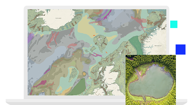
Living Atlas contains a wealth of environmental data that helps researchers and policymakers monitor ecosystems, manage natural resources, and address the impacts of climate change. Key datasets include:
- Land Cover and Use: Global land cover datasets that provide information about forests, wetlands, agricultural areas, and urban developments.
- Deforestation and Reforestation: Datasets that track forest loss and gain, essential for environmental conservation efforts.
- Biodiversity and Protected Areas: Information on wildlife habitats and protected conservation areas, useful for managing biodiversity.
Environmental organizations can leverage this data to track changes in land use, plan conservation efforts, and develop sustainable resource management strategies.
c. Climate and Weather Data
Climate and weather data are essential for addressing issues like disaster management, agriculture, and climate resilience. ArcGIS Living Atlas provides:
- Real-time Weather Data: Current information on temperature, precipitation, and extreme weather events.
- Climate Change Projections: Data on long-term climate trends, including projections of temperature rise, sea-level changes, and the impact of global warming on specific regions.
This data is particularly valuable for agricultural planners and governments preparing for the effects of climate change, allowing them to mitigate risks such as droughts, floods, and crop failure.
d. Transportation and Infrastructure
Urban development depends on a deep understanding of existing transportation networks and infrastructure. Living Atlas offers datasets related to:
- Road Networks: Comprehensive data on highways, streets, and transportation systems.
- Public Transit Systems: Information on bus routes, train lines, and other public transportation infrastructures.
- Utility Networks: Maps of water, electricity, and communication systems that are vital for city planning and resource management.
Transportation authorities and urban planners can use this data to optimize transportation systems, reduce traffic congestion, and improve access to public services.
e. Real-Time Data
One of the standout features of ArcGIS Living Atlas is its real-time data offerings, which include:
- Disaster Event Tracking: Real-time updates on natural disasters such as wildfires, floods, and earthquakes.
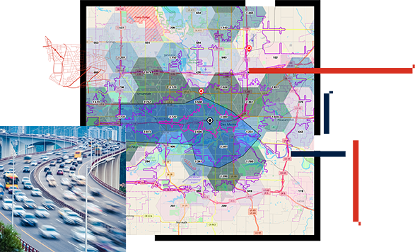
- Traffic Data: Live traffic information that helps transportation planners and emergency response teams react to changing conditions.
This data is crucial for disaster management and emergency response, enabling authorities to make quick, informed decisions in rapidly evolving situations.
Related: A Deep Dive into Africa GeoPortal: Essential Tools for GIS Professionals
How to Access ArcGIS Living Atlas
Accessing ArcGIS Living Atlas is easy through Esri’s ArcGIS Online or ArcGIS Pro. Users can browse the Living Atlas gallery to find datasets relevant to their projects, filter by categories such as environment, transportation, or demographics, and add layers to their maps for further analysis. The integration of Living Atlas data into workflows allows users to perform spatial analysis, visualize complex datasets, and make evidence-based decisions.
For instance, urban planners using ArcGIS Pro can overlay population data with transportation networks to design more efficient public transit routes, or environmentalists can monitor deforestation trends in real-time to allocate resources for conservation efforts.
Unlock the power of reliable geospatial data with ArcGIS Living Atlas—visit the Esri Eastern Africa Online Store to explore tools that will transform your GIS projects!

