Discover What’s New in ArcGIS Online (November 2024)
December 4, 2024 2024-12-04 13:30Discover What’s New in ArcGIS Online (November 2024)
Discover What’s New in ArcGIS Online (November 2024)
ArcGIS Online continues to enhance the way we connect people, locations, and data through interactive maps and powerful tools. Whether as a standalone, cloud-based platform or integrated with ArcGIS Pro and ArcGIS Enterprise, ArcGIS Online supports your ability to create and share maps, apps, and insights that leverage location intelligence.
This November 2024 update introduces innovative features, enhanced workflows, and expanded customization options. Key improvements include updates to Map Viewer, Experience Builder, and Instant Apps, as well as new functionality across the platform.
For full details on this release, explore the What’s New help topic, or check out the overview video.
Highlights of the Update
Map Viewer Enhancements
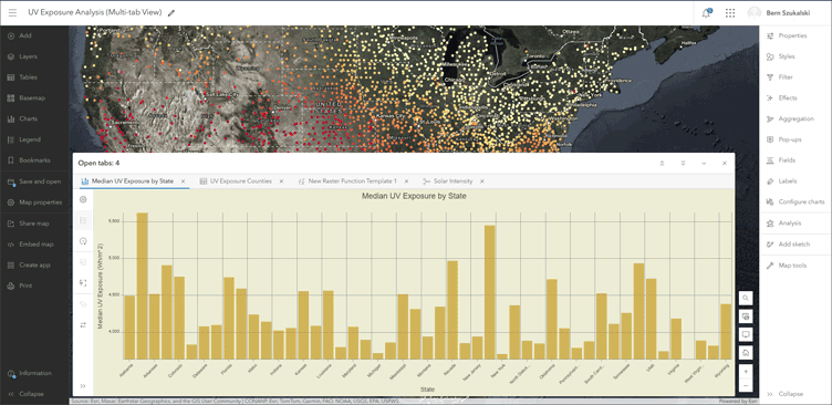
- Multi-Tab Support: Users can now switch between open tables, charts, models, and raster function templates via tabs at the bottom of the map. Tabs can be adjusted for height, minimized, or closed to maximize map visibility.
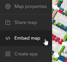
- Embed Maps Tool: Share maps effortlessly using a new embedding tool. Customize map design, choose light or dark modes, and copy the generated HTML for integration into blogs or websites.
- Enhanced Table Features: Improvements to table functionality include the ability to use Arcade or SQL for field calculations, manage attachments, and save field configurations directly to web maps.
- Improved Charts: New options for customizing chart sorting, temporal axis guides, and bar chart creation make visual data analysis more effective.
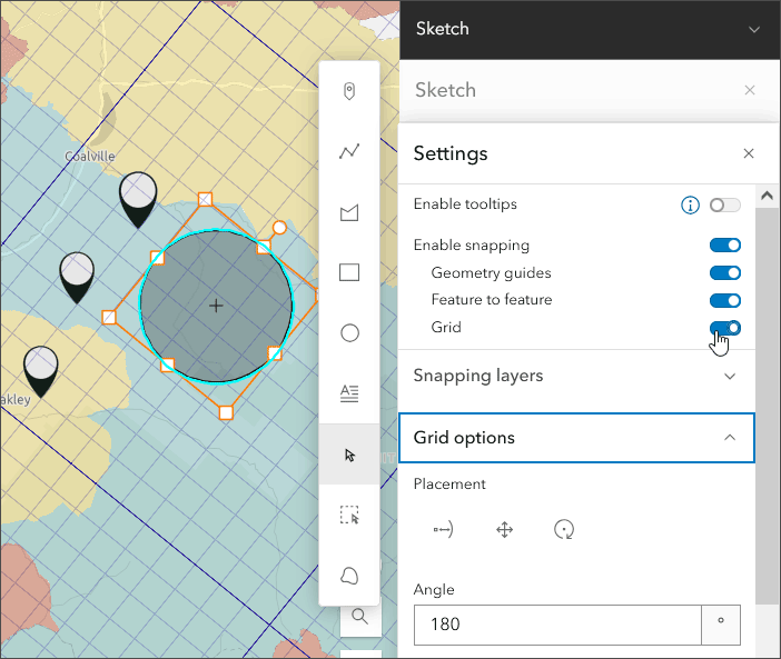
- Sketch Layer Updates: Custom grids and symbols, along with editable features and advanced layouts using CSS grids and flexbox, provide greater flexibility when designing maps.
Spatial Analysis and ModelBuilder (Beta)
- ModelBuilder: Now in beta, this tool allows users to build, automate, and document analysis workflows on an interactive canvas. Workflows can integrate multiple tools, save outputs as layers, and streamline complex processes.
- New Analysis Tools: Enhancements to raster functions and new templates, such as algae bloom monitoring and cloud-free image composites, expand the possibilities for data analysis.
Scene Viewer Updates
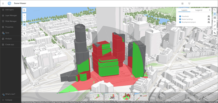
- Viewshed Analysis: Easily visualize lines of sight by generating viewshed layers in 3D scenes. Adjust parameters interactively and share saved viewshed layers.
- Improved Tools: Spatial analysis tools are now available in Scene Viewer, allowing for in-depth data exploration and decision-making.
Enhancements for Developers and Administrators
- Custom Basemap Settings: Organizations can now define basemaps for dark and light modes, supporting workflows that align with user preferences and organizational standards.
- Expanded Styling Options: Aggregation styles now support lines, polygons, and points. Fonts in text and labels now include a list of map-specific fonts for enhanced consistency.
- Support for Oriented Imagery Layers: Map Viewer and Scene Viewer now support oriented imagery, enabling richer visualizations.
Applications and Templates
- Instant Apps: Updated templates offer new ways to create intuitive apps quickly.
- Experience Builder Express Mode: Simplifies app creation, making it accessible for all users.
- Dashboards and Notebooks: Usability and performance enhancements streamline workflows for data analysis and presentation.
For more updates, check the www.blog.easriea.com or explore detailed posts related to this release. Stay ahead by leveraging these advancements to unlock the full potential of ArcGIS Online.
This Aricle was first written by Bern Szukalski and Jennifer Wrightsell-Hughes. See full Article here


