Implementing ArcGIS Urban for Smart City Planning
June 24, 2024 2024-06-24 14:35Implementing ArcGIS Urban for Smart City Planning
Implementing ArcGIS Urban for Smart City Planning
In an era where urbanization is accelerating at an unprecedented rate, the need for effective and sustainable city planning has never been greater. Smart city initiatives are at the forefront of this transformation, leveraging technology to enhance urban living, improve efficiency, and foster sustainability. One of the most powerful tools available for this purpose is ArcGIS Urban. This article delves into the implementation of ArcGIS Urban for smart city planning, highlighting its features, benefits, and real-world applications.
Related: Transforming Urban Planning with ArcGIS: A New Era of Smart Cities
What is ArcGIS Urban?
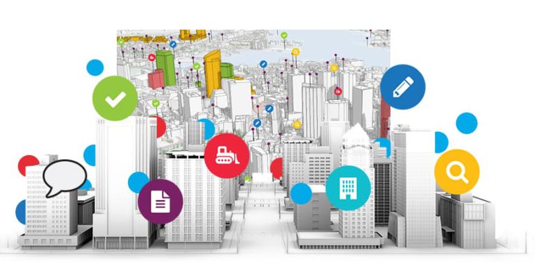
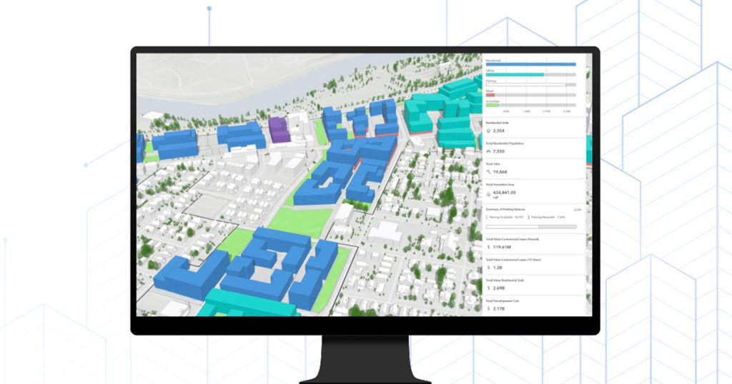
ArcGIS Urban is a web-based 3D application designed to improve urban planning and decision-making. It provides city planners, architects, and developers with a comprehensive platform to visualize, analyze, and share information about urban environments. By integrating various datasets into a cohesive 3D model, ArcGIS Urban enables stakeholders to collaboratively design and manage cities more efficiently and sustainably.
Key Features of ArcGIS Urban
- 3D Visualization:
- Create and visualize 3D models of urban environments, including buildings, infrastructure, and green spaces.
- Enhance understanding of spatial relationships and the impact of proposed developments.
- Scenario Planning:
- Develop and compare multiple planning scenarios to evaluate potential outcomes and impacts.
- Use real-time data to inform decision-making and optimize planning processes.
- Stakeholder Engagement:
- Facilitate collaboration and communication among stakeholders through interactive 3D models and dashboards.
- Share planning scenarios and gather feedback from the public and other interested parties.
- Data Integration:
- Integrate various datasets, including zoning codes, land use data, transportation networks, and demographic information.
- Ensure comprehensive analysis and informed decision-making by leveraging diverse data sources.
- Performance Metrics:
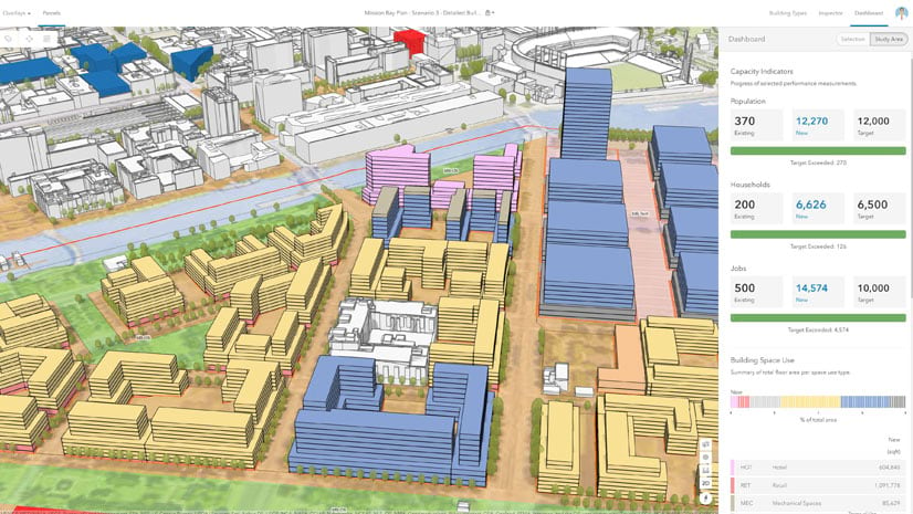
- Track and analyze key performance indicators (KPIs) to assess the impact of urban planning initiatives.
- Monitor progress towards sustainability goals and make data-driven adjustments as needed.
Related: Leveraging GIS for Sustainable African Cities
Benefits of Implementing ArcGIS Urban
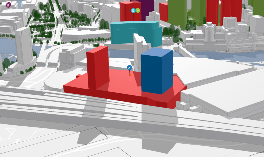
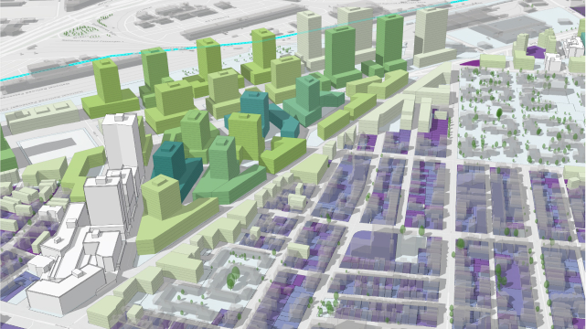
- Enhanced Visualization and Understanding: ArcGIS Urban’s 3D visualization capabilities provide a more intuitive understanding of urban spaces. Planners can see the spatial relationships between different elements, such as buildings, roads, and green spaces, which helps in assessing the potential impact of new developments.
- Improved Decision-Making: By allowing planners to create and compare multiple scenarios, ArcGIS Urban facilitates better decision-making. Real-time data integration ensures that planning decisions are based on the most current information, leading to more effective and sustainable outcomes.
- Increased Stakeholder Collaboration: The interactive nature of ArcGIS Urban’s 3D models fosters greater collaboration among stakeholders. Planners, developers, and the public can engage with the models, providing feedback and insights that can be incorporated into the planning process. This collaborative approach helps build consensus and ensures that urban development projects meet the needs of the community.
- Efficient Resource Management: ArcGIS Urban enables planners to optimize the use of resources by analyzing various data points and performance metrics. This data-driven approach ensures that resources are allocated efficiently, reducing waste and promoting sustainability.
- Public Engagement and Transparency: One of the key benefits of ArcGIS Urban is its ability to engage the public in the planning process. By providing accessible and interactive 3D models, citizens can better understand proposed developments and their potential impacts. This transparency builds trust and encourages community involvement in urban planning initiatives.
Real-World Applications of ArcGIS Urban
- Zoning and Land Use Planning: ArcGIS Urban helps city planners visualize and analyze zoning regulations and land use patterns. By integrating zoning codes and land use data, planners can identify areas for potential development or redevelopment, ensuring that land use aligns with community goals and regulatory requirements.
- Transportation Planning: Effective transportation planning is crucial for smart city initiatives. ArcGIS Urban allows planners to model transportation networks, assess traffic patterns, and evaluate the impact of new infrastructure projects. This helps in designing efficient transportation systems that reduce congestion and promote sustainable mobility options.
- Sustainability and Resilience: With growing concerns about climate change and urban resilience, ArcGIS Urban provides tools to assess the sustainability of urban development projects. Planners can model the impact of developments on energy consumption, carbon emissions, and green spaces, ensuring that new projects contribute to a more sustainable and resilient urban environment.
- Housing and Community Development: ArcGIS Urban aids in planning for housing and community development by integrating demographic data and housing trends. Planners can identify areas in need of affordable housing, assess the impact of new housing projects on communities, and ensure that developments meet the needs of residents.
- Economic Development: By visualizing economic data and development trends, ArcGIS Urban supports economic development initiatives. Planners can identify opportunities for commercial development, assess the economic impact of proposed projects, and plan for the growth of business districts.
Steps to Implement ArcGIS Urban for Smart City Planning
- Data Collection and Integration: Gather and integrate relevant datasets, including zoning codes, land use data, transportation networks, and demographic information. Ensure data accuracy and consistency to support effective analysis and decision-making.
- Model Creation and Visualization: Create detailed 3D models of the urban environment using ArcGIS Urban. Visualize existing conditions and proposed developments to assess spatial relationships and potential impacts.
- Scenario Planning and Analysis: Develop multiple planning scenarios to evaluate different development options. Use real-time data and performance metrics to analyze the potential outcomes and impacts of each scenario.
- Stakeholder Engagement: Share 3D models and planning scenarios with stakeholders, including the public, developers, and government officials. Gather feedback and incorporate insights into the planning process to ensure that developments meet the needs of the community.
- Monitoring and Adjustment: Track key performance indicators and monitor the progress of urban development projects. Make data-driven adjustments as needed to optimize outcomes and ensure that projects contribute to the overall goals of the smart city initiative.
As urbanization continues to accelerate, the implementation of advanced technologies like ArcGIS Urban will be crucial in addressing the challenges and opportunities of modern city planning. Embrace the future of smart city planning with ArcGIS Urban and create a better urban environment for all.

