Implementing Location-Based Marketing Strategies with ArcGIS
June 21, 2024 2024-06-21 18:04Implementing Location-Based Marketing Strategies with ArcGIS
Implementing Location-Based Marketing Strategies with ArcGIS
In the digital age, businesses are increasingly turning to innovative technologies to enhance their marketing strategies. One such powerful tool is Geographic Information Systems (GIS), specifically ArcGIS. Location-based marketing leverages geographic data to deliver personalized and relevant marketing messages to consumers based on their physical location. This blog post explores how businesses can implement effective location-based marketing strategies using ArcGIS, driving customer engagement and improving marketing ROI.
Related: ArcGIS Business Analyst: A Powerful Tool for Market Analysis and Planning

Understanding location-based marketing
Location-based marketing (LBM) is a direct marketing strategy that uses a consumer’s location data to tailor marketing messages. This approach relies on geographic data collected from various sources such as GPS-enabled devices, social media check-ins, and transaction histories. LBM can take many forms, including geofencing, proximity marketing, and location-based advertising, each aimed at reaching consumers with contextually relevant information.
The role of ArcGIS in location-based marketing
ArcGIS is a leading GIS platform that offers robust tools for collecting, analyzing, and visualizing geographic data. Businesses can leverage ArcGIS to enhance their location-based marketing strategies in several ways:
- Customer segmentation and targeting: ArcGIS allows businesses to analyze demographic and psychographic data to identify and segment their target audience. By understanding the geographic distribution of their customers, businesses can tailor their marketing messages to meet the specific needs and preferences of different segments.
- Site selection and market analysis: With ArcGIS, businesses can perform detailed site selection and market analysis. This involves evaluating potential locations for new stores, analyzing competitive landscapes, and identifying areas with high market potential. Such insights help businesses make informed decisions about where to focus their marketing efforts.
- Geofencing and proximity marketing: ArcGIS enables the creation of geofences—virtual boundaries around specific locations. When customers enter these geofenced areas, they can receive targeted marketing messages, such as promotions or coupons. This real-time engagement enhances customer experience and increases the likelihood of conversion.
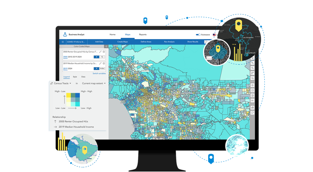
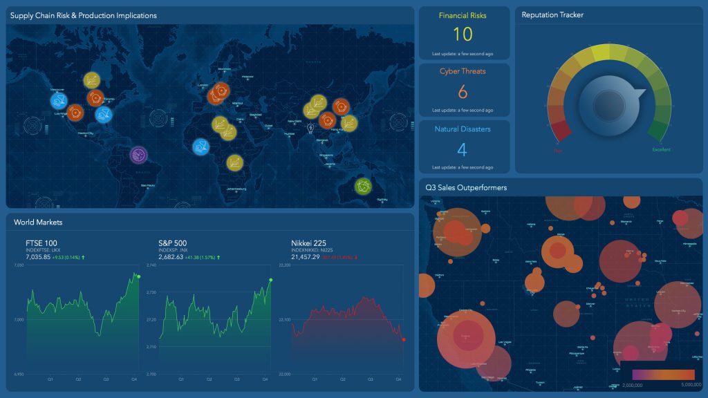
- Spatial data visualization: One of the strengths of ArcGIS is its ability to visualize complex data sets. Businesses can create interactive maps and dashboards that display customer locations, sales data, and other key metrics. These visualizations help in identifying trends and patterns that inform marketing strategies.
- Integration with other marketing tools: ArcGIS can be integrated with various CRM and marketing automation platforms. This integration ensures that geographic data is seamlessly incorporated into broader marketing strategies, enabling businesses to deliver cohesive and targeted campaigns.
Related: Maps for Marketers

Implementing location-based marketing strategies with ArcGIS
To successfully implement location-based marketing strategies using ArcGIS, businesses should follow these steps:
1. Data collection and preparation
The first step is to collect relevant geographic data. This includes customer addresses, transaction histories, and social media interactions. ArcGIS provides tools for importing and managing this data, ensuring it is accurate and up-to-date.
2. Customer segmentation
Using ArcGIS, businesses can segment their customers based on geographic and demographic factors. For example, a retailer might segment customers by proximity to store locations, income levels, or purchasing behavior. These segments can then be targeted with specific marketing messages.
3. Geospatial analysis
ArcGIS offers advanced geospatial analysis tools that allow businesses to analyze patterns and trends in their data. For instance, heat maps can be created to show areas with high customer density, and spatial clustering can identify regions with similar customer characteristics.
4. Geofencing and campaign execution
With ArcGIS, businesses can set up geofences around key locations, such as retail stores or event venues. Marketing campaigns can then be configured to trigger when customers enter these geofenced areas. For example, a coffee shop could send a discount coupon to customers who enter a geofence around their location during morning hours.
5. Monitoring and optimization
ArcGIS provides real-time monitoring and analytics capabilities. Businesses can track the performance of their location-based marketing campaigns through interactive dashboards. By analyzing this data, businesses can refine their strategies, optimize their campaigns, and improve ROI.
Implementing location-based marketing strategies with ArcGIS provides businesses with a competitive edge by enabling precise targeting and personalized customer engagement. The ability to analyze and visualize geographic data helps businesses understand their market, optimize their marketing efforts, and improve overall ROI. As the digital landscape continues to evolve, leveraging GIS technology like ArcGIS will be crucial for businesses looking to stay ahead in the marketing game.
Ready to transform your marketing strategies with the power of GIS? Contact us today to learn more and start enhancing your customer engagement with precise, data-driven insights.


