Meet Mercy – Our Q1 Intern’s GIS Adventure at Esri Eastern Africa!
April 2, 2025 2025-04-24 12:14Meet Mercy – Our Q1 Intern’s GIS Adventure at Esri Eastern Africa!

Hey there, GIS enthusiasts! Meet Mercy—a passionate Geospatial Engineering graduate from the University of Nairobi who recently completed an incredible internship at Esri Eastern Africa. If you love maps, data, and visualization, then you’ll want to hear about her exciting journey in the world of Geographic Information Systems (GIS)!
Diving Into the GIS Universe at Esri EA
Before stepping into Esri EA, Mercy thought ArcGIS was just about maps and spatial analysis. Little did she know, it’s an entire ecosystem of powerful geospatial solutions! Her internship was a perfect blend of academic knowledge and hands-on experience, giving her the chance to work on real-world projects that push the boundaries of GIS innovation.
The Project: A Centralized Carbon Project Database
Picture this—a one-stop digital hub where Kenya’s carbon credit projects are submitted and tracked in real time. Mercy took on the challenge of building this platform using Esri’s robust ArcGIS system. Here’s how she made it happen:
✔ ArcGIS Pro & Image Analyst – Transforming raw spatial data into clean, insightful maps and processing images for carbon stock estimation.
✔ ArcGIS Dashboards – Providing real-time analytics for project tracking.
✔ Survey123 & ArcGIS Online – Enabling seamless mobile data collection and cloud storage.
✔ Workflow Manager – Automating approval processes and project verification.
✔ Remote Sensing & Change Detection – Using GIS analytics to verify carbon sequestration.
✔ Power Automate Integration – Sending instant notifications when a new project is submitted.
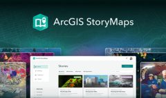
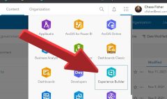
✔ Story Maps & Experience Builder – Bringing the project to life through interactive storytelling.
This hands-on experience not only sharpened her technical skills but also deepened her understanding of how GIS can drive sustainability and climate action.
Beyond Just Mapping – Insights Gained
At Esri EA, Mercy discovered that GIS is more than just creating maps—it’s about making data-driven decisions that shape industries, policies, and sustainable solutions. Here are some key takeaways from her journey:
GIS is a Decision-Making Powerhouse – From businesses to governments and NGOs, location intelligence is transforming how decisions are made.
Automation is the Future – With tools like ArcGIS Workflow Manager & Power Automate, manual bottlenecks become a thing of the past.
User-Centered Design is Key – Mercy’s background in graphic design helped her create intuitive dashboards and visually engaging geospatial tools, proving that design matters in GIS!
What’s Next for Mercy?
A huge shoutout to the Esri EA team for the mentorship, support, and fostering an environment of continuous learning! This internship solidified Mercy’s passion for leveraging GIS in sustainable development and climate action. Moving forward, she’s eager to work on GIS-driven solutions that mitigate climate change—whether it’s carbon credit projects, disaster resilience, or environmental monitoring.
As Mercy puts it, “This is just the start! Or as we say in Kenya, ‘Mbele iko sawa!’”
Stay tuned for more inspiring GIS stories from our interns and team members at Esri Eastern Africa!