Nairobi: Spatial Data and Maps Empower Advocacy for the Urban Poor
November 15, 2024 2024-11-15 14:00Nairobi: Spatial Data and Maps Empower Advocacy for the Urban Poor
Nairobi: Spatial Data and Maps Empower Advocacy for the Urban Poor
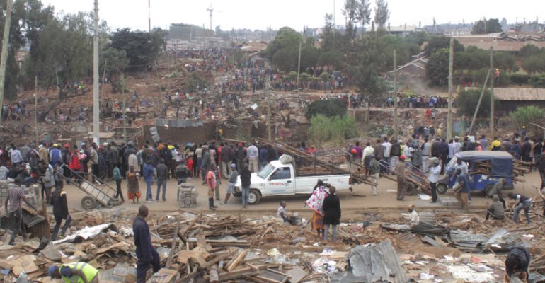
In May 2020, during a COVID-19 lockdown in Nairobi, Kenya, approximately 7,000 people in the low-income Kariobangi settlement were forcibly evicted to clear land for a sewer infrastructure project. In the following days, demolitions destroyed much of the area, displacing residents.
News of the crisis reached Pamoja Trust, a Kenyan advocacy group for urban poor communities. Recognizing the potential for more evictions tied to similar projects, Pamoja Trust partnered with Cadasta, a global nonprofit specializing in land and resource rights technology. The goal was to rapidly gather evidence to advocate against further displacement and to raise awareness among vulnerable communities.
Related: Maps and Apps Revolutionize Water Management in Arusha City

Using GIS technology, the teams reviewed Nairobi’s sewerage plans. By overlaying demolition zones with population density data from Facebook’s Data for Good initiative and aerial imagery, they uncovered a startling reality: six additional demolition sites threatened the homes of over 70,000 people in Nairobi’s informal settlements.
The Vulnerability of Nairobi’s Urban Poor
The Kariobangi demolitions highlighted long-standing challenges for Nairobi’s informal settlements, which house up to 70% of the city’s nearly five million residents. Despite their large population, these communities lack basic services and legal land protections, leaving residents at constant risk of eviction. Without formal land rights, these settlements are often deemed uninhabited, enabling governments to bypass regulations like advance notice, compensation, or relocation provisions during public works projects.

Empowering Communities Through Data and Advocacy
Pamoja Trust and Cadasta used GIS tools to create interactive maps that visualized the population density and demolition zones, highlighting the human cost of the sewerage project. This information was shared with community coalitions, such as Muungano wa Wanavijiji, Kenya’s urban poor federation. The maps galvanized communities to take action, leading to government petitions and halting the sewerage plans temporarily.
While the sewerage improvements remain critical for Nairobi’s development, the advocacy ensured that affected communities are now part of the discussion. This inclusion enables more equitable solutions, such as compensation or alternative housing arrangements.
Related: KenGen’s GIS Portal Fueling a Digital Transformation

A Sustainable Model for Advocacy
The collaboration between Pamoja Trust and Cadasta exemplifies “data empowerment,” which equips communities with tools and information to advocate for themselves. By making informal settlements visible through spatial data, residents can demonstrate their contributions to the city and negotiate for the protection of their homes and livelihoods.
Disclaimer: This article was originally written by Jen Van Deusen.
Discover more about how GIS is empowering communities and driving impactful change by visiting our store.

