Tips and Tricks with ArcGIS QuickCapture
March 20, 2024 2024-03-20 9:45Tips and Tricks with ArcGIS QuickCapture
Tips and Tricks with ArcGIS QuickCapture
In the realm of Geographic Information Systems (GIS), data collection is the cornerstone of informed decision-making. Whether it’s mapping natural resources, monitoring infrastructure, or conducting field surveys, the ability to efficiently capture accurate spatial data is essential for successful GIS projects. This is why ArcGIS QuickCapture – a powerful mobile app designed to streamline the data collection process and empower field workers to collect data with speed and precision comes into play. In this article, we’ll explore some tips and tricks for maximizing the efficiency of GIS data collection using ArcGIS QuickCapture.
Related: ArcGIS Navigator – The Ultimate GPS Navigation Solution

Understanding ArcGIS QuickCapture
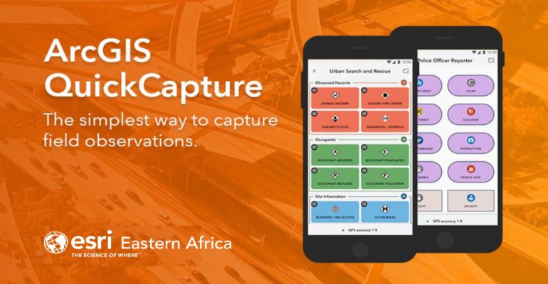
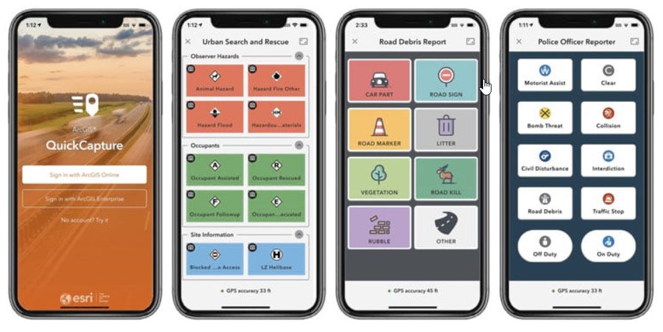
ArcGIS QuickCapture is a mobile app that simplifies the process of capturing field data using smartphones or tablets. Unlike traditional data collection methods that require manual input or complex forms, ArcGIS QuickCapture utilizes a simple, intuitive interface with large buttons that correspond to predefined data types or actions. This “point and tap” approach allows field workers to quickly capture data with minimal effort, making it ideal for rapid data collection in the field.
Tips for Efficient GIS Data Collection
Here are some tips for efficient GIS data collection:
1. Plan your data collection project
Before heading into the field, take the time to plan your data collection project carefully. Define your objectives, identify the data attributes you need to capture, and determine the spatial extent of your project area. By having a clear plan in place, you can ensure that your data collection efforts are focused and efficient.
2. Customize your QuickCapture projects
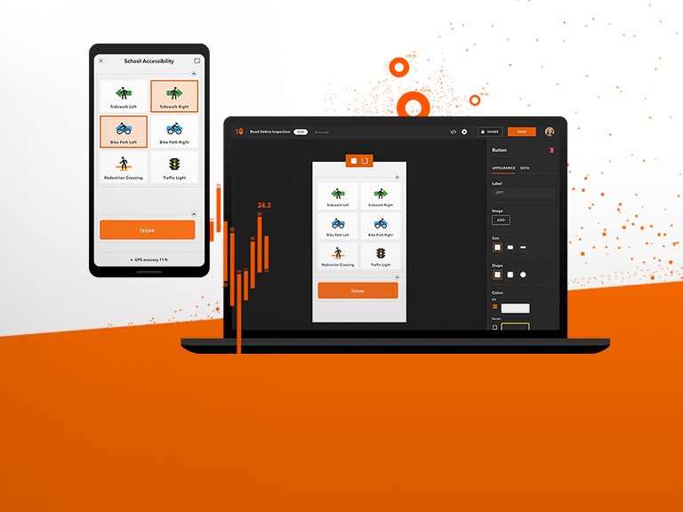
ArcGIS QuickCapture allows users to create custom projects tailored to their specific data collection needs. Take advantage of this feature by designing projects with predefined data types, attributes, and workflows. By customizing your projects upfront, you can streamline the data collection process and ensure consistency across your field teams.
3. Optimize your data collection workflow
When designing your QuickCapture projects, think about the most efficient workflow for capturing data in the field. Arrange your buttons in a logical order that mirrors the sequence of data collection activities. Consider grouping related data types together and organizing buttons based on frequency of use to minimize the time spent navigating the app.
4. Leverage built-in GPS capabilities
ArcGIS QuickCapture leverages the built-in GPS capabilities of mobile devices to capture accurate location data automatically. Ensure that your device’s GPS settings are enabled and that you have a clear view of the sky to maximize GPS accuracy. Consider using external GPS receivers for enhanced precision in areas with poor satellite reception.
Related: Maximizing Efficiency with ArcGIS Field Apps and Mobile Data Collection

5. Utilize attachments for additional context
In addition to capturing spatial data, ArcGIS QuickCapture allows users to attach photos, videos, and audio recordings to their data points. Take advantage of this feature to provide additional context or documentation for your field observations. Attachments can be invaluable for validating data quality, conducting site assessments, or documenting field conditions.
6. Take advantage of offline data collection
One of the key advantages of ArcGIS QuickCapture is its ability to work offline, allowing field workers to collect data in remote or disconnected areas. Prior to heading into the field, download basemaps and project data for offline use to ensure uninterrupted data collection. Sync your data when you’re back online to update your GIS database and share your findings with stakeholders.
7. Practice, iterate, and improve
Like any tool, proficiency with ArcGIS QuickCapture comes with practice. Take the time to familiarize yourself with the app’s features and functionality before embarking on your data collection project. Iterate on your project designs based on feedback from field workers, and continuously look for ways to improve your data collection workflow for maximum efficiency.
Efficient GIS data collection is essential for generating accurate, reliable, and actionable spatial information. With ArcGIS QuickCapture, field workers can streamline the data collection process and capture data with speed and precision, whether they’re mapping natural resources, monitoring infrastructure, or conducting field surveys. By following these tips and tricks, you can maximize the efficiency of your GIS data collection efforts and unlock new opportunities for informed decision-making in the field.

