Tips & Tricks: Field Data Collection Best Practices
April 16, 2024 2024-04-16 8:41Tips & Tricks: Field Data Collection Best Practices
Tips & Tricks: Field Data Collection Best Practices
Field data collection serves as the cornerstone for building accurate and insightful spatial databases. Whether you’re conducting environmental surveys, asset inventories, or infrastructure assessments, mastering field data collection techniques is essential for GIS professionals. In this blog article, we’ll delve into some indispensable tips and tricks to optimize your field data collection practices in GIS and ensure the integrity and reliability of your spatial datasets.
Related: From Field to Map – Collecting and Analyzing Data With ArcGIS

Field data collection best practices
Here are some tips and tricks to optimize your field data collection practices:
Define clear objectives
Before venturing into the field, establish clear objectives for your data collection project. Define the specific geographic features or attributes you need to capture and the purpose behind collecting this information. Understanding the goals of your project will guide your data collection efforts and help prioritize data attributes that are most critical for your GIS analysis.
Select the right tools
Choosing the appropriate tools for field data collection is crucial for success. As a GIS professional, you have a wide array of options, including handheld GPS devices, smartphones, tablets, and ruggedized data collectors. Select tools that are compatible with your GIS software and offer features such as GPS integration, data synchronization, and offline data collection capabilities to ensure seamless integration with your GIS workflows.

Utilize GIS mobile applications
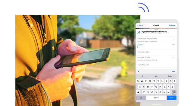
Leverage GIS mobile apps to streamline field data collection processes and enhance productivity. Apps like ArcGIS Collector, and ArcGIS Survey123 provide intuitive interfaces for capturing spatial data, attribute information, and multimedia attachments directly in the field. Take advantage of customizable forms, GPS tracking, and offline data collection functionalities to collect data efficiently and accurately.
Standardize data collection procedures
Establish standardized data collection procedures to maintain consistency and accuracy across different field teams and projects. Develop clear guidelines for data entry formats, attribute values, and quality control measures to ensure uniformity in collected data. Provide training and resources to field staff to ensure adherence to established protocols and minimize errors in data collection.
Related: Maximizing Efficiency With ArcGIS Field Apps and Mobile Data Collection

Optimize GPS accuracy
Ensure optimal GPS accuracy to capture precise location information during field data collection. Minimize signal interference by conducting data collection in open areas away from obstructions such as tall buildings or dense vegetation. Calibrate GPS devices regularly and utilize differential correction techniques, such as Real-Time Kinematic (RTK) or post-processing, to enhance the accuracy of GPS data collected in challenging environments.
Implement data validation checks
Integrate data validation checks into your field data collection workflows to detect and correct errors in real-time. Utilize validation rules and constraints to enforce data integrity and prevent inaccuracies in collected data. Perform field checks and verifications to validate the accuracy of collected data against ground truth or reference datasets, ensuring the reliability of your GIS database.

Embrace collaboration and data sharing
Collaboration and data sharing among field teams, stakeholders, and GIS professionals to maximize the value of collected data. Utilize cloud-based GIS platforms and collaboration tools to facilitate communication, data exchange, and collaboration in real-time. Share field data, insights, and best practices to foster collective learning and improve decision-making processes in GIS projects.
By incorporating these tips and tricks into your field data collection practices in GIS, you can enhance data quality, accuracy, and reliability, ultimately enabling more informed decision-making and analysis in your GIS projects. Remember to continuously evaluate and refine your data collection workflows to adapt to evolving project requirements and technological advancements in the field of GIS.


