Top Datasets from ArcGIS Living Atlas for Urban Planning and Development
October 14, 2024 2024-10-14 8:35Top Datasets from ArcGIS Living Atlas for Urban Planning and Development
Top Datasets from ArcGIS Living Atlas for Urban Planning and Development
Urban planning and development have become increasingly complex as cities grow and face challenges like population density, transportation, environmental sustainability, and infrastructure management. Geographic Information Systems (GIS) provide the tools and data needed to address these challenges, enabling planners to make informed, data-driven decisions. One of the most valuable resources for urban planners today is the ArcGIS Living Atlas of the World, which offers a wealth of datasets that can be applied to a wide range of urban development projects.
In this article, we’ll explore the top datasets available in ArcGIS Living Atlas that can help planners and decision-makers design smarter, more sustainable cities.
1. Population and Demographic Data
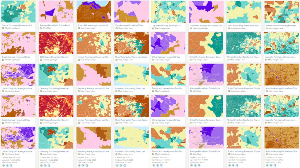
One of the most critical aspects of urban planning is understanding population dynamics. ArcGIS Living Atlas provides high-quality demographic data at local, regional, and global scales, which helps planners analyze population growth, density, age distribution, income levels, and more.
Key Datasets:
- Esri’s Demographics: This dataset offers population density, household income, age distribution, and other demographic information. It is crucial for planning services like healthcare, education, and housing.
- World Population Density: This global dataset provides insight into how populations are distributed across the world, helping planners focus on areas where urban growth and development are most needed.
- Living Atlas Demographic Layers: Updated annually, these layers offer insights into household characteristics, migration patterns, and income levels, assisting planners in predicting future growth areas and targeting specific demographic needs.
Use Case: A city planner working on expanding healthcare services can use population density data and household income levels to identify underserved areas that require new clinics or hospitals.
Explore: https://livingatlas.arcgis.com/en/browse/
2. Land Use and Zoning Maps
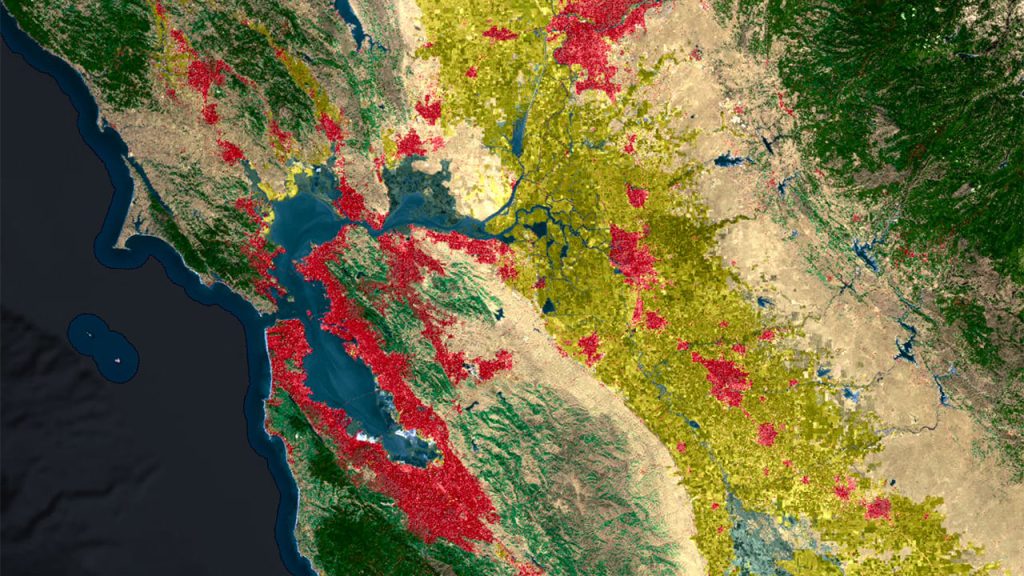
Understanding land use patterns is essential for sustainable urban development. Planners need to know which areas are designated for residential, commercial, industrial, or green spaces to make informed zoning and development decisions.
Key Datasets:
- USGS National Land Cover Database (NLCD): This dataset provides comprehensive information about land cover across the U.S., offering insights into urban areas, forests, wetlands, and agricultural lands.
- Esri Land Use Layers: Esri’s land use datasets are globally comprehensive and provide detailed information on how land is being used—whether for agriculture, commercial development, or urban expansion.
- European Urban Atlas: This dataset provides detailed land use maps for European cities, offering a wealth of information on urban expansion, green spaces, and transportation networks.
Use Case: When deciding where to build new housing developments, planners can use land use data to identify areas zoned for residential use and analyze surrounding infrastructure to ensure the new development is well-connected to essential services.
3. Transportation Networks and Infrastructure Data
Transportation is the backbone of any city, and urban planners need detailed information on existing roads, railways, public transit routes, and walkability to make effective decisions about future infrastructure investments.
Key Datasets:
- ArcGIS StreetMap Premium: This dataset provides detailed information on streets, highways, and public transportation networks globally. It includes travel speeds, traffic conditions, and routing information that planners can use to optimize transportation systems.
- Global Roads Open Access Data Set (gROADS): This dataset offers a global view of roads and transportation networks, helping planners identify gaps in connectivity, plan new roads, and improve access to underserved communities.
- OpenStreetMap Layers: These datasets provide up-to-date transportation data, including road networks, bicycle lanes, and pedestrian paths, which are valuable for designing multimodal transport systems.
Use Case: Urban planners aiming to reduce traffic congestion can use ArcGIS StreetMap Premium to analyze current traffic flows, identify bottlenecks, and plan new roads or public transit routes to ease congestion.
4. Green Spaces and Environmental Data
Urban planners are increasingly focused on creating sustainable, livable cities that balance development with environmental preservation. Green spaces like parks, wetlands, and forests are essential for improving air quality, reducing heat islands, and providing recreation areas.
Key Datasets:
- Global Forest Watch: This real-time dataset provides information on forest cover, deforestation, and reforestation efforts, helping planners protect green spaces and combat urban sprawl.
- Urban Heat Island Maps: These datasets show how heat is distributed across urban areas, highlighting hotspots that need additional green spaces or cooling infrastructure.
- Protected Areas and National Parks: Datasets such as the World Database on Protected Areas (WDPA) provide detailed information on protected land and conservation areas, helping planners incorporate green spaces into urban designs.
Use Case: A planner designing a new urban district can use heat island data to identify areas prone to extreme heat and incorporate more green spaces and parks to mitigate the effects of urban warming.
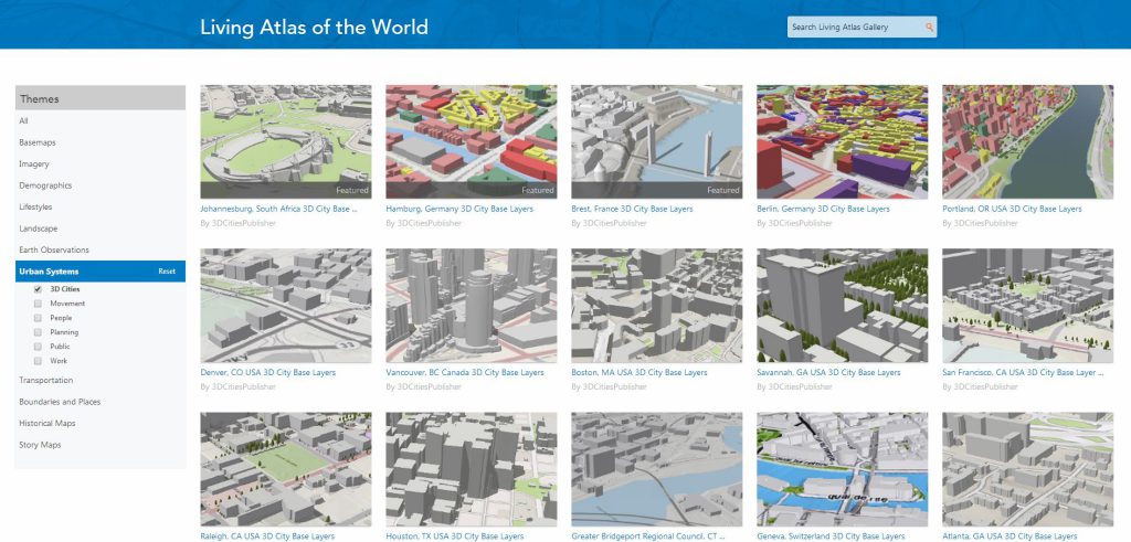
5. Building Footprints and 3D Urban Models
Building footprint data allows urban planners to visualize existing infrastructure, assess building density, and plan for future development. 3D models provide an even more detailed view, helping planners assess the impact of new developments on skylines, shadows, and infrastructure.
Key Datasets:
- Microsoft Building Footprints: This dataset includes over 125 million building footprints across the U.S., providing a comprehensive view of existing structures and their spatial distribution.
- Esri 3D Basemaps: Esri offers a collection of 3D urban models for various cities, providing planners with a detailed view of building heights, floor space, and skyline analysis.
- OpenBuildings from Google: This dataset offers building footprints across the globe, giving planners a comprehensive view of urban density and development patterns.
Use Case: When planning a new skyscraper in a city center, planners can use 3D models to visualize how the new building will impact the skyline and its surrounding infrastructure, ensuring the project is aligned with the city’s development goals.
6. Utilities and Public Services
Efficient management of utilities such as water, electricity, and waste management is critical to the functioning of any city. Urban planners need access to utility data to ensure that new developments are supported by adequate infrastructure.
Key Datasets:
- Esri Water Distribution Network: This dataset provides insights into the location of water distribution systems, reservoirs, and pipelines, helping planners ensure access to clean water for all city residents.
- Energy Grids and Substations: Datasets like Esri’s electric network maps provide detailed information on the location of power grids, substations, and renewable energy sources.
- Waste Management Infrastructure: This dataset provides information on the location of waste collection points, recycling centers, and landfills, helping cities optimize their waste management systems.
Use Case: A city planner developing a new residential area can use utility network data to ensure that the new development has access to reliable water, electricity, and waste services before construction begins.
7. Climate and Weather Data
As climate change becomes a growing concern, urban planners must integrate climate resilience into their designs. This includes preparing for extreme weather events like floods, hurricanes, and heatwaves.
Key Datasets:
- Global Climate Data: Esri’s climate data layers provide long-term historical data on temperature, precipitation, and extreme weather events. Planners can use this data to design resilient infrastructure that can withstand climate change impacts.
- NOAA Weather Data: This real-time dataset provides weather forecasts and extreme weather alerts, helping planners make informed decisions during construction phases or emergency planning.
- FEMA Flood Zones: These datasets show areas that are prone to flooding, helping planners avoid building in high-risk areas or design flood mitigation systems like levees and retention basins.
Use Case: A coastal city planner can use FEMA flood zone data and global climate models to design flood-resistant infrastructure and protect coastal areas from rising sea levels.
8. Economic and Business Data
Urban planning isn’t just about buildings and roads—it’s also about fostering economic growth. Economic datasets from the Living Atlas can help planners assess business opportunities, identify growth sectors, and plan for commercial development.
Key Datasets:
- Esri Business Analyst Data: This dataset provides information on business types, locations, revenue, and market trends, helping planners design economic zones and commercial districts that align with local demand.
- Retail Market Potential: This dataset offers insights into consumer spending patterns and retail market potential, allowing planners to assess where new retail or commercial developments would be most successful.
Use Case: A planner deciding where to build a new shopping center can use retail market potential data to identify high-demand areas and ensure that the development will attract customers and succeed financially.
ArcGIS Living Atlas of the World offers urban planners a wealth of high-quality, reliable datasets that are critical for informed decision-making in urban development. From population data and transportation networks to environmental and climate information, these datasets provide the insights needed to design smarter, more sustainable cities.
By leveraging these resources, urban planners can enhance their analysis, optimize infrastructure development, and create urban environments that are both resilient and responsive to the needs of their citizens. Whether you’re working on a small community project or a large-scale urban expansion, ArcGIS Living Atlas provides the tools and data you need to make informed, data-driven decisions that will shape the future of cities.
Start transforming your urban planning projects today with powerful data from ArcGIS Living Atlas—visit the Esri Eastern Africa Online Store to explore the tools that can help you build smarter, more sustainable cities!

