Transforming Interior Spaces with ArcGIS Indoors
March 15, 2024 2024-03-15 13:18Transforming Interior Spaces with ArcGIS Indoors
Transforming Interior Spaces with ArcGIS Indoors
In the world of architecture, design, and urban planning, the importance of spatial intelligence cannot be overstated. Understanding how people interact with the built environment on a granular level is crucial for creating spaces that are not just aesthetically pleasing but also functional and efficient. This is why ArcGIS Indoors is changing the game when it comes to interior space planning and management.
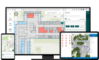
ArcGIS Indoors, is a powerful indoor mapping and spatial analytics platform that enables users to visualize, navigate, and manage indoor spaces in intricate detail. Whether it’s a commercial office building, a shopping mall, a university campus, or a hospital, ArcGIS Indoors provides the tools needed to unlock the full potential of interior spaces.
So, how exactly does ArcGIS Indoors work, and how can it be leveraged to transform interior spaces? Let’s delve into the comprehensive guide.
Related: ArcGIS Indoors – Smart Workplaces, Efficient Operations


Understanding the basics of ArcGIS Indoors
At its core, ArcGIS Indoors utilizes a combination of indoor maps, location data, and spatial analytics to provide users with a holistic view of interior spaces. The platform integrates seamlessly with existing GIS (Geographic Information Systems) data, allowing users to create detailed indoor maps that accurately represent the layout and features of buildings.
One of the key features of ArcGIS Indoors is its ability to capture and visualize indoor positioning data. By leveraging technologies such as Bluetooth beacons, Wi-Fi signals, and RFID tags, ArcGIS Indoors can track the real-time location of assets, people, and equipment within a building. This data can then be analyzed to gain insights into how spaces are being utilized and identify opportunities for optimization.

The Benefits of ArcGIS Indoors for interior space transformation
1. Enhanced spatial planning
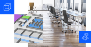
ArcGIS Indoors provides architects, designers, and facility managers with the tools needed to optimize the layout of interior spaces. By visualizing occupancy patterns, traffic flows, and utilization rates, stakeholders can make informed decisions about space allocation, furniture placement, and workflow optimization.
2. Improved navigation and wayfinding
Navigating large indoor environments can be challenging, especially for visitors and newcomers. ArcGIS Indoors offers interactive maps and navigation tools that make it easy for users to find their way around complex buildings. Whether it’s locating a specific room, finding the nearest restroom, or identifying accessible routes, ArcGIS Indoors enhances the overall user experience.

3. Streamlined facility management
For facility managers tasked with maintaining and operating large buildings, ArcGIS Indoors provides valuable insights into building performance and resource allocation. By monitoring equipment status, tracking maintenance activities, and identifying potential bottlenecks, facility managers can ensure that buildings operate smoothly and efficiently.

4. Data-driven decision making
By capturing and analyzing indoor spatial data, organizations can make data-driven decisions about space utilization, resource allocation, and facility investments. Whether it’s optimizing workspace design, identifying areas for improvement, or planning for future expansion, ArcGIS Indoors empowers stakeholders to make informed choices that drive business success.

Getting Started with ArcGIS Indoors
If you’re ready to harness the power of ArcGIS Indoors to transform your interior spaces, here are some steps to get started:
- Define your objectives: Determine your goals and objectives for using ArcGIS Indoors. Whether it’s improving spatial efficiency, enhancing user experience, or optimizing facility management, having a clear vision will guide your implementation strategy.
- Collect and prepare data: Gather existing floor plans, building layouts, and spatial data relevant to your project. Ensure that the data is accurate, up-to-date, and compatible with ArcGIS Indoors.
- Design your indoor maps: Use ArcGIS Indoors’ intuitive mapping tools to create detailed indoor maps that accurately represent your building’s layout and features. Consider adding additional layers for amenities, points of interest, and navigation routes.
- Deploy location sensors: Deploy location sensors such as Bluetooth beacons or Wi-Fi access points to enable indoor positioning and real-time tracking within your building.
- Customize and configure: Tailor ArcGIS Indoors to meet your specific needs by customizing map styles, configuring navigation options, and defining user permissions.
- Train your team: Provide training and support to your team members to ensure they are proficient in using ArcGIS Indoors and maximizing its potential.
- Monitor and iterate: Continuously monitor the performance of your indoor spaces using ArcGIS Indoors’ analytics tools. Identify areas for improvement and iterate on your designs to optimize space utilization and user experience.
ArcGIS Indoors represents a paradigm shift in how we understand and interact with interior spaces. By leveraging the power of spatial intelligence, organizations can unlock new opportunities for efficiency, productivity, and innovation within their buildings.


