What’s New in ArcGIS Maritime – November 2024
November 19, 2024 2024-11-19 13:24What’s New in ArcGIS Maritime – November 2024
What’s New in ArcGIS Maritime – November 2024
The latest ArcGIS Maritime update introduces powerful tools and enhancements to improve chart creation and maritime data management.
Related: What’s New in ArcGIS Drone2Map 2024.2
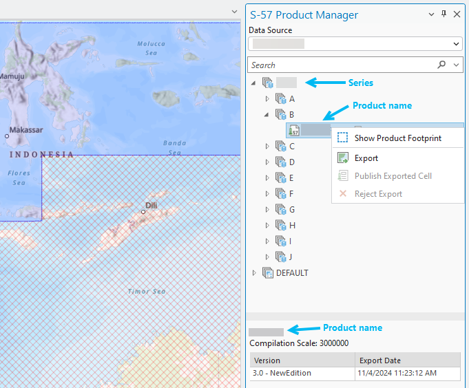
S-57 Product Management
The new S-57 Product Manager in ArcGIS Pro streamlines the management, publishing, and exporting of S-57 products. Now integrated into the Maritime S-57 tab, this tool lets you view and organize products directly from the Product Manager pane.

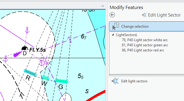
Light Sector Editing
With ArcGIS Pro 3.4, the Edit Light Sector tool allows adjustments to existing light sector lines and color arcs. Users can easily modify lengths and placements, improving clarity and reducing conflicts with other chart elements.

Scale Band Enhancements
The updated S-57 Set Scale Band group now includes an Append Filter tool, enabling users to revise filters, add layers to queries, and toggle conflation, making data filtering more efficient.

Maritime Server Updates
ArcGIS Maritime Server, part of ArcGIS Enterprise 11.4, introduces enhanced custom symbology for features like wrecks and navigation lines. Additional Lua properties allow for better dataset scaling, and new labeling options, such as the rotateWithFeature Lua property, align text with features seamlessly.
For more details, visit the ArcGIS Maritime page or join the Esri Community to ask questions and explore documentation.
Disclaimer: This Article was originally written by By Krista Carlson. View full article here


