What’s New in ArcGIS Online (June 2024)
July 8, 2024 2024-07-08 9:31What’s New in ArcGIS Online (June 2024)
ArcGIS Online is a powerful tool that enables users to understand the world through interactive maps, connecting people, locations, and data. It offers data-driven styles and intuitive analysis tools, providing location intelligence and the capability to create and share maps and apps. Whether used as a complete cloud-based solution or in conjunction with ArcGIS Pro and ArcGIS Enterprise, ArcGIS Online enhances the user’s ability to visualize and analyze spatial data.
Key Updates in June 2024
The June 2024 update brings several significant features and enhancements, including a new recycle bin for deleted items, updated user types, and the introduction of ArcGIS Web Editor. Here are the highlights:
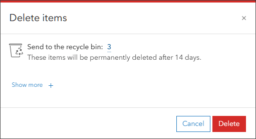
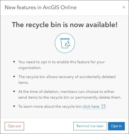
Recycle Bin: A new recycle bin feature allows administrators to control whether deleted items are held for 14 days before being permanently deleted. This feature is enabled by default for new organizations and can be opted out by administrators. Existing organizations can choose to opt in at their convenience. Administrators can track items in the recycle bin using an enhanced item report.
Map Viewer Enhancements:
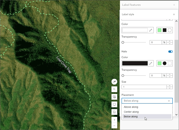
Labeling: Users can now adjust label positions along lines and customize label backgrounds.
Field Management: Users can add and delete fields in hosted feature layers or tables and calculate field values using Arcade expressions.
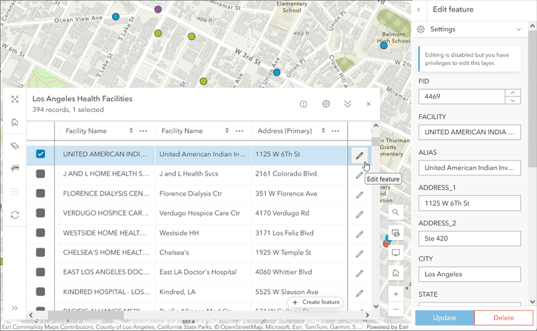
Attribute Table Enhancements: Users can create and edit features directly from the attribute table and view related records.
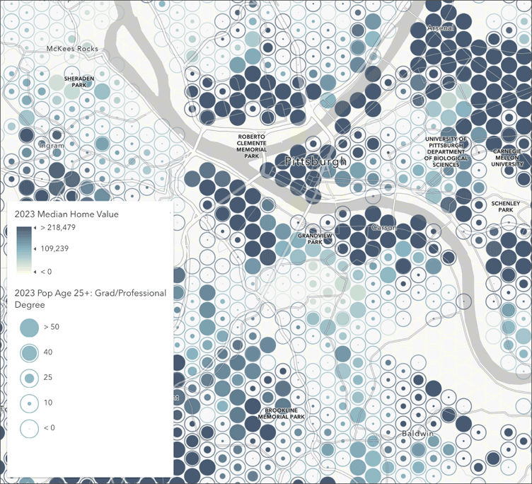
Reference Size Theme: A new theme allows visualization of values in relation to one another using bounding outlines.
Arcade Support for Aggregation: Custom Arcade expressions can be used to determine data clustering or binning.
Imagery Display: Improved support for multidimensional imagery layers and a new dimension slider for animations.
Time Field Filters: Filters can now be applied to time fields.
Analysis in Map Viewer:
- User Type Updates: Changes in user types affect access to image analysis capabilities.
- Custom Web Tools: Web tools published from Notebooks can be run directly within Map Viewer.
- Raster Function Templates: The Analysis pane now includes a tab for creating and modifying raster function templates.
- Enhanced Analysis Tools: New options and improved performance for various analysis tools, such as Join Features, Enrich Layer, Zonal Statistics, Distance Accumulation, and Distance Allocation.
Scene Viewer Enhancements:
- Time Slider: Allows visualization of time-enabled layers with options to animate and navigate time periods.
- Catalog and Media Layer Support: Adding catalog and media layers for dynamic visualization.
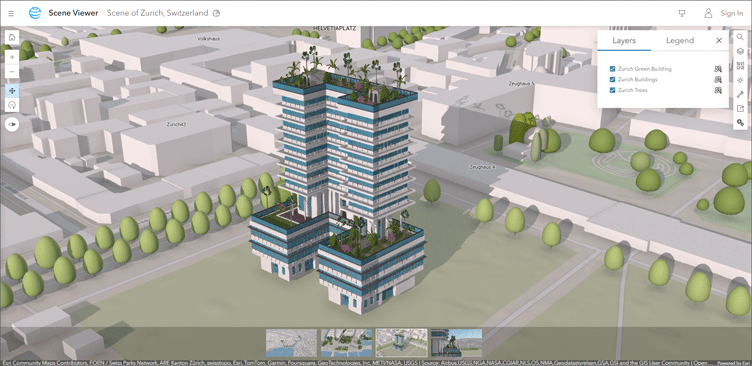
- Enhanced 3D Visualization: Improved customization for layer placement and shading for integrated mesh layers.
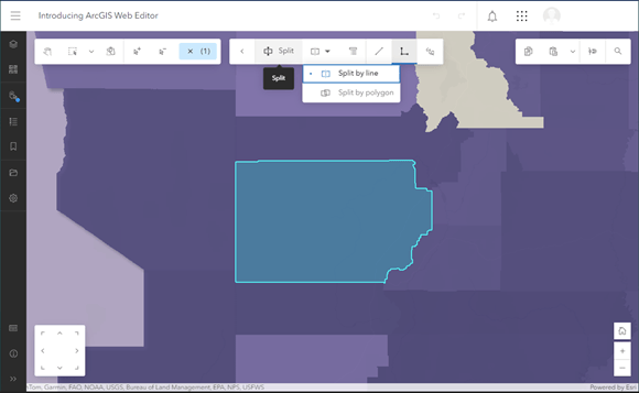
ArcGIS Web Editor: ArcGIS Web Editor is a new app for a focused, efficient editing experience. It includes tools for creating and updating features, editing attributes and related records, and using constraints and snapping.
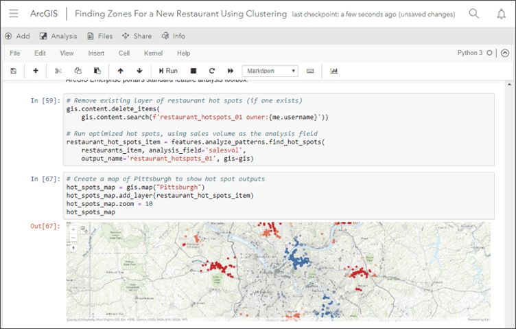
ArcGIS Notebooks:
- Publish as Web Tools: Notebooks can now be published as web tools, enabling broader application and integration of analytical models.
- Updated Python Libraries: Includes new versions of the ArcGIS API for Python, ArcPy, and open-source libraries.
Content Management:
- Offline Map Settings: Improved settings for configuring maps for offline use.
- True Curve Features: Hosted feature layers can now store and manage true curve features.
- Date Field Support: New date field types are recognized for various file formats.
- Sharing and Collaboration: Enhanced sharing of metadata in distributed collaborations.
Accounts and Administration:
- User Type Updates: Expanded access to ArcGIS capabilities without affecting current workflows.
- Administrative Reports: Enhanced credit and item reports with detailed information on usage and items in the recycle bin.
- Premium Feature Data Store: Increased storage capacity for M2 and M3 stores, providing greater flexibility for data workflows.
Apps and App Builders:
- ArcGIS Instant Apps: New and updated app templates, including features like language switcher, improved home page, and apps like Reporter, Atlas, Exhibit, and Attachment Viewer.
- ArcGIS Experience Builder: New templates and widgets, enhanced data source support, and improved user interface elements.
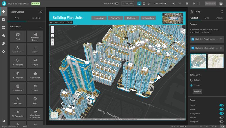
- ArcGIS Dashboards: New themes, attribute updates, 3D support, and other enhancements for better data visualization and interactivity.
- ArcGIS Data Pipelines: New inputs and enhanced tools for data integration and processing, with improved scheduling and credit management.
For more details, visit the ArcGIS Online help topic or view all related posts. Watch the introductory video to see these new capabilities in action. Join the ArcGIS Online Esri Community to ask questions, view blogs, learn from peers, and submit ideas for future enhancements.
Disclaimer: This Article was first written and published by Bern Szukalski and Jennifer Wrightsell-Hughes. View full article here.


