What’s New in ArcGIS Urban (March 2025)
March 28, 2025 2025-03-28 8:58What’s New in ArcGIS Urban (March 2025)
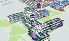
The latest ArcGIS Urban update introduces projects, a powerful new feature that allows planners to upload and analyze 3D models within a shared system. This enhances the planning process by providing a detailed spatial representation of site developments at various stages.
Related: What’s New in ArcGIS StoryMaps (January 2025)
Solving Key Planning Challenges
The new projects feature addresses common urban planning issues:
- Limited Development Visibility – Planners lacked a unified view of projects in progress.
- Inaccessible 3D Data – Models were stored in multiple formats requiring specialized tools.
- Inconsistent Reviews – Stakeholders used different tools, leading to mismatched analyses.
With projects, planners can now store, edit, and analyze site plans efficiently in one place.
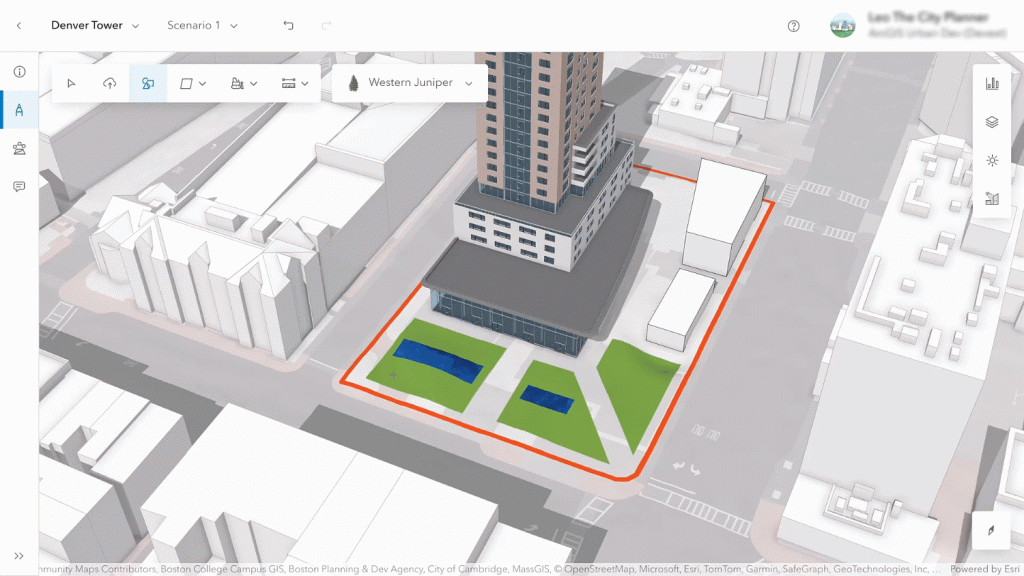
Managing Site Plans with Projects
Projects support various levels of detail, from initial sketches to fully detailed BIM models. The improved editing experience allows users to:
- Configure project details (name, thumbnail, status, description).
- Upload 3D models and create basic sketches.
- Add assets like trees and other site elements.
- Use a new editing toolbar for quick modifications.
The revamped user interface streamlines project organization, making it easier to navigate and edit.
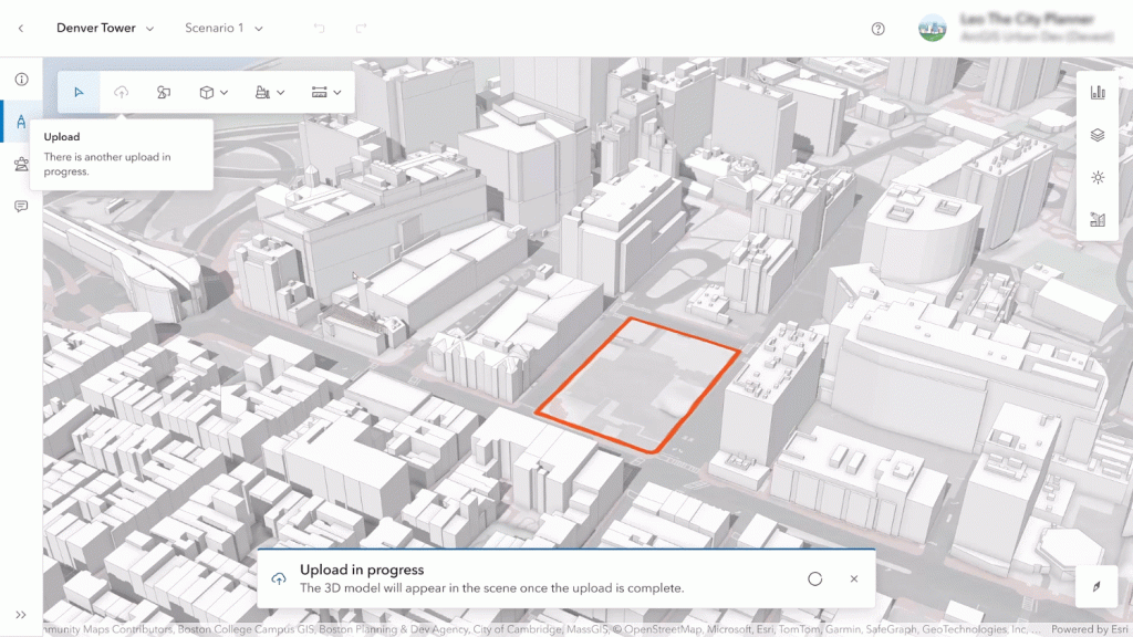
Seamless 3D Model Upload
When developers submit detailed 3D models for approvals, planners can now quickly upload and visualize them in ArcGIS Urban. Supported file formats include IFC, DWG, FBX, and OBJ, with no modifications to the original files.
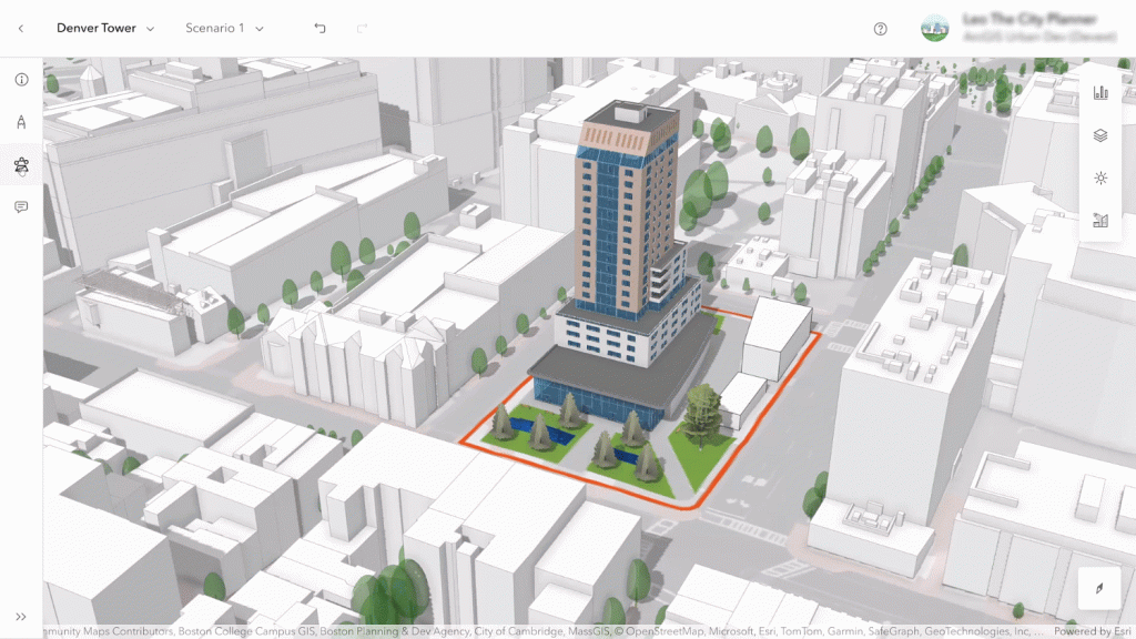
Once uploaded, the model is converted into a 3D object feature layer, allowing planners to:
- Adjust position, elevation, orientation, and scale within the project editor.
- Store and retrieve models in the 3D system of record for future reference.
Enhanced Project Impact Analysis
The new analysis mode helps planners assess how a development affects its surroundings using familiar tools like:
- Shadow cast – Evaluates sunlight impact.
- Elevation profile – Examines height variations.
- Line of sight & viewshed – Simulates visibility from different vantage points.
Users can now save and retrieve analyses, ensuring consistent evaluations over time.
Integrating Projects into Urban Planning
Projects now seamlessly integrate with zoning and land-use plans, providing a holistic view of urban development. In the overview mode, planners can:
- View color-coded projects based on status.
- Analyze developments within zoning boundaries.
- Display surrounding projects in 3D for better context.
Additional Updates
- Blueprint Uploads – Users can now upload, georeference, and store blueprints as media layers within site plans.
- Urban API Enhancements – The API now supports retrieving 3D object layers and analysis configurations, enabling integration with other tools.
The new projects feature in ArcGIS Urban transforms site planning by enabling a comprehensive 3D system of record, eliminating the need for specialized tools, and improving collaboration among planners, developers, and stakeholders.
Disclaimer: This article was originally written by Lisa Staehli and Ricardo Cabrera Nyst and Katie Thompson. View full article here: https://www.esri.com/arcgis-blog/products/urban/announcements/whats-new-in-arcgis-urban-march-2025